Flight: 08-052-00
Date: 26 Oct 2007
Location: Southern California Fires
Deployment: WSFM 2007
Configuration: Land 2.5 (12-Channel)
Principal Investigators: Ambrosia (CSUMB)
Additional Sensors: None
|
Fire Coverage
Buckweed / Ranch / Slide / Santiago / Ammo
Rice / Poomacha / Witch / Harris
|
Data Evaluation
Overall quality is good
|
Processing Information
Level-1B Data in HDF format is available
Flight Line Summary
Spectral Band Configuration
Spectral Response Function Table
Spectral Response Function (text)
|
Browse Imagery
Flight Tracks: 44
Scanlines: 126438
|
Browse Imagery Table
|
Click a Flight Track number to view a quicklook image
Lat/Lon ranges are for the BEG-END scanline nadir pixels
|
Flight
Track |
Time Span
(GMT) |
Heading
(Deg) |
Lat Range
(Deg N) |
Lon Range
(Deg W) |
Length
(Scanlines) |
Altitude
(Meters) |
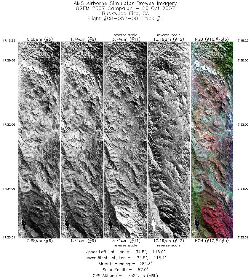
| 1 |
17:19 - 17:25 |
279.3 |
34.437 - 34.555 |
117.996 - 118.414 |
3316 |
7323 |
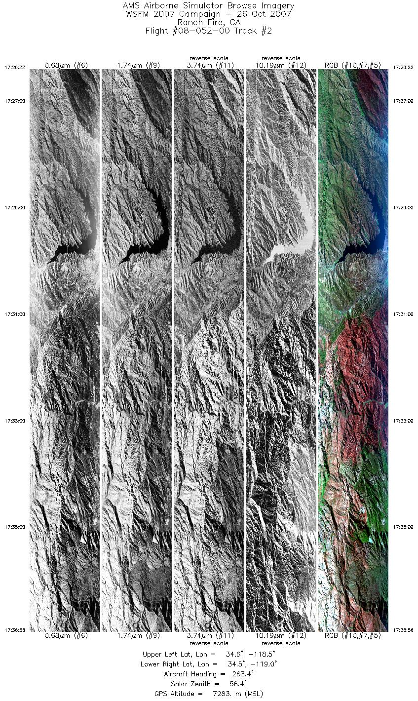
| 2 |
17:26 - 17:36 |
262.1 |
34.557 - 34.568 |
118.464 - 118.963 |
5703 |
7289 |
| 3 |
17:41 - 17:45 |
96.5 |
34.504 - 34.497 |
118.876 - 118.703 |
1908 |
7283 |
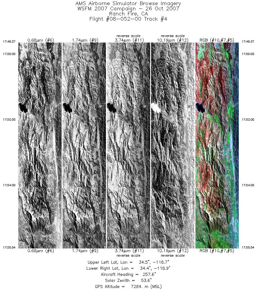
| 4 |
17:49 - 17:55 |
261.3 |
34.434 - 34.439 |
118.638 - 118.940 |
3390 |
7285 |
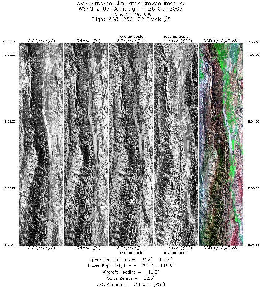
| 5 |
17:58 - 18:04 |
105.5 |
34.376 - 34.376 |
118.946 - 118.628 |
3273 |
7283 |
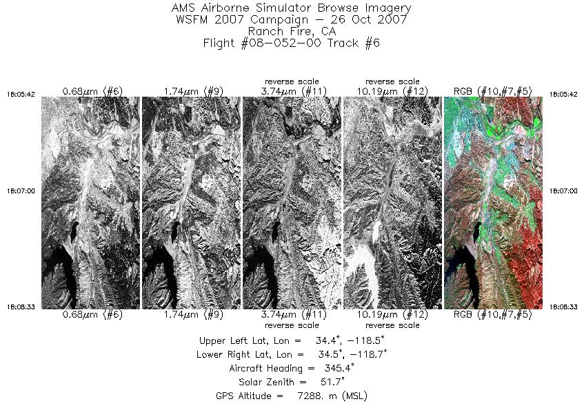
| 6 |
18:05 - 18:08 |
341.0 |
34.409 - 34.544 |
118.596 - 118.645 |
1540 |
7287 |
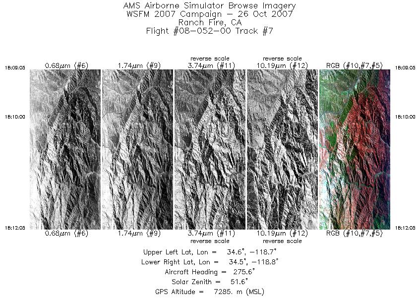
| 7 |
18:09 - 18:12 |
268.3 |
34.561 - 34.576 |
118.665 - 118.814 |
1619 |
7285 |
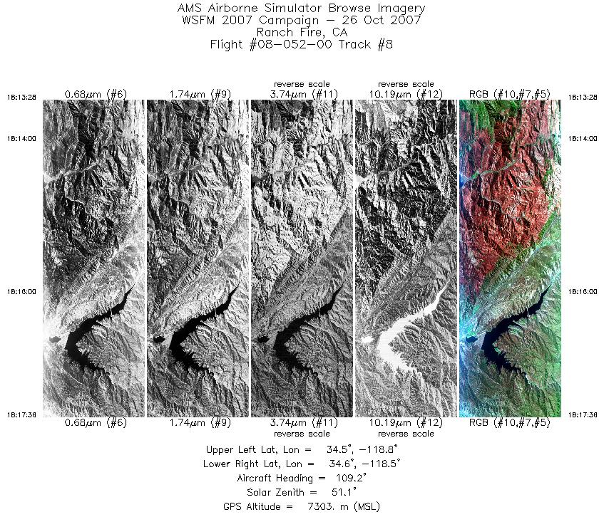
| 8 |
18:13 - 18:17 |
102.3 |
34.543 - 34.549 |
118.815 - 118.538 |
2231 |
7300 |
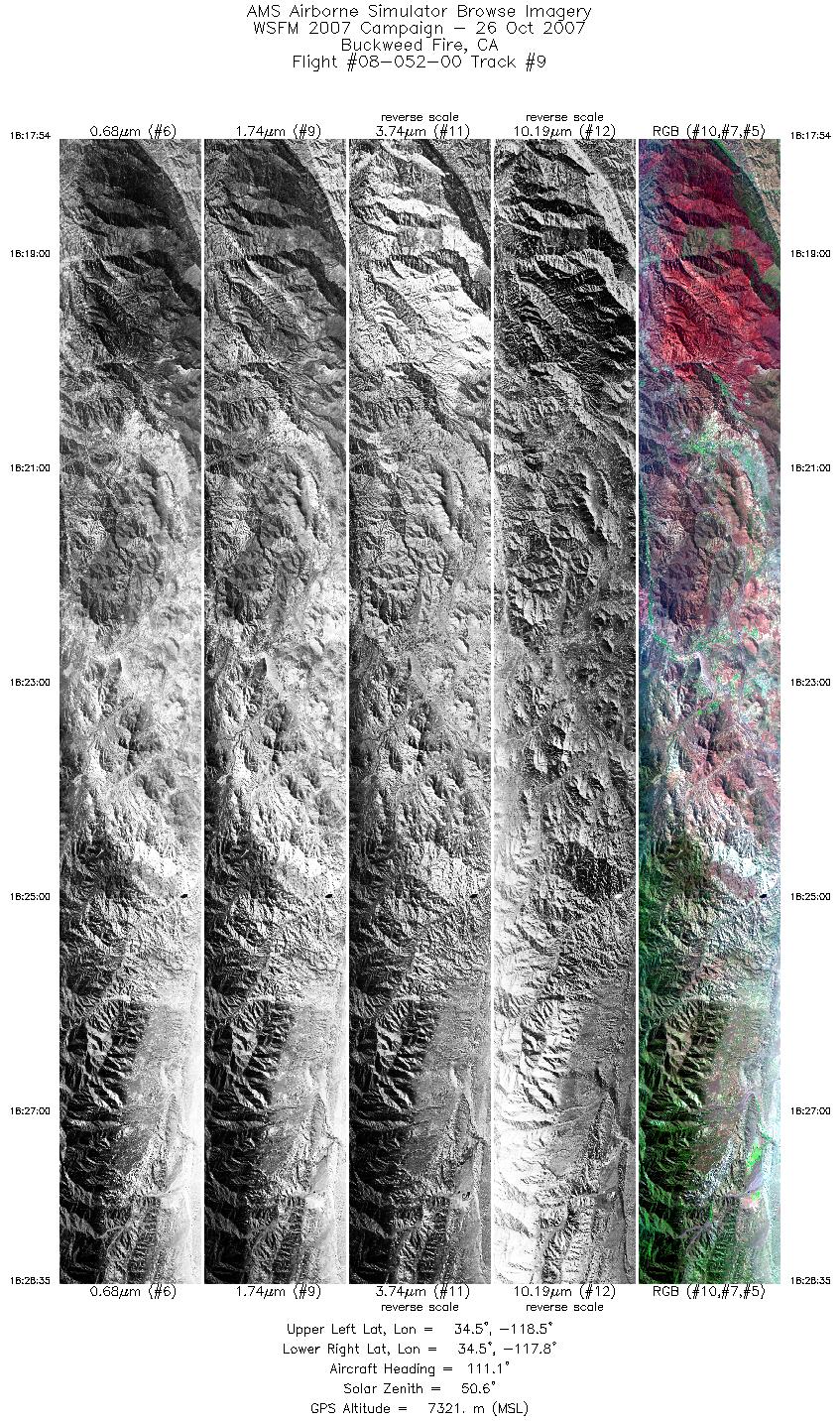
| 9 |
18:17 - 18:28 |
109.2 |
34.547 - 34.407 |
118.518 - 117.789 |
5774 |
7321 |
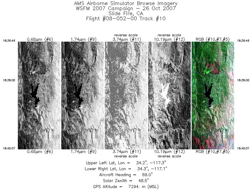
| 10 |
18:36 - 18:40 |
92.3 |
34.266 - 34.267 |
117.271 - 117.103 |
1811 |
7302 |
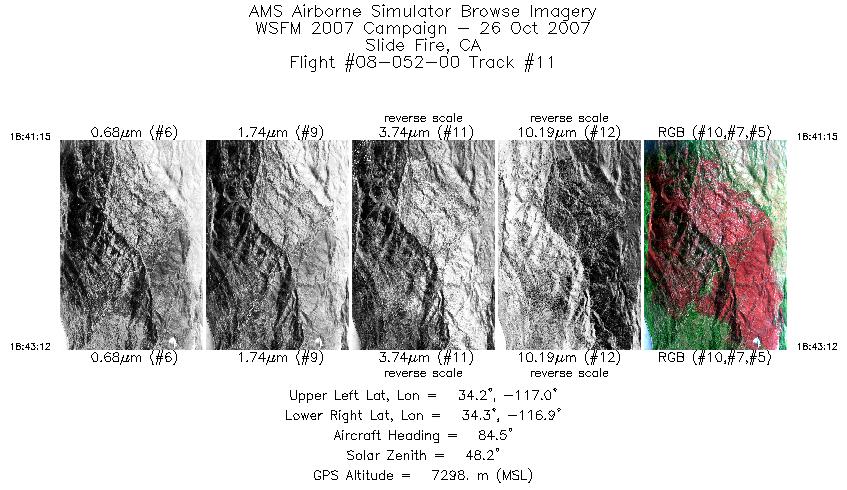
| 11 |
18:41 - 18:43 |
87.4 |
34.287 - 34.296 |
117.049 - 116.951 |
1052 |
7298 |
| 12 |
18:45 - 18:50 |
265.2 |
34.244 - 34.246 |
116.979 - 117.187 |
2334 |
7303 |
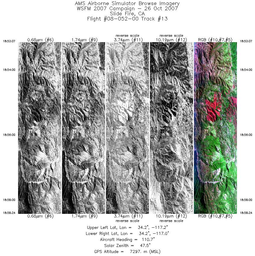
| 13 |
18:53 - 18:58 |
106.3 |
34.208 - 34.182 |
117.220 - 116.967 |
2852 |
7295 |
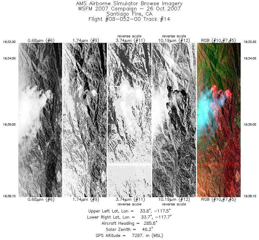
| 14 |
19:33 - 19:38 |
288.5 |
33.703 - 33.774 |
117.504 - 117.705 |
2521 |
7288 |
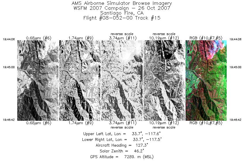
| 15 |
19:44 - 19:46 |
124.2 |
33.708 - 33.657 |
117.607 - 117.499 |
1404 |
7288 |
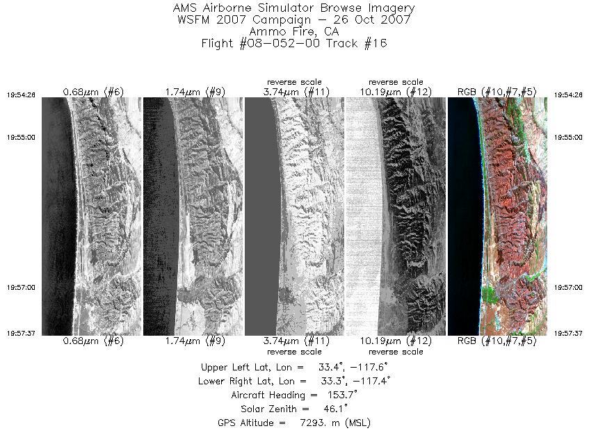
| 16 |
19:54 - 19:57 |
148.0 |
33.386 - 33.287 |
117.535 - 117.434 |
1716 |
7294 |
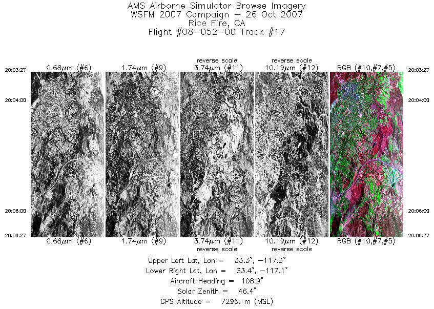
| 17 |
20:03 - 20:06 |
108.0 |
33.405 - 33.374 |
117.262 - 117.111 |
1616 |
7294 |
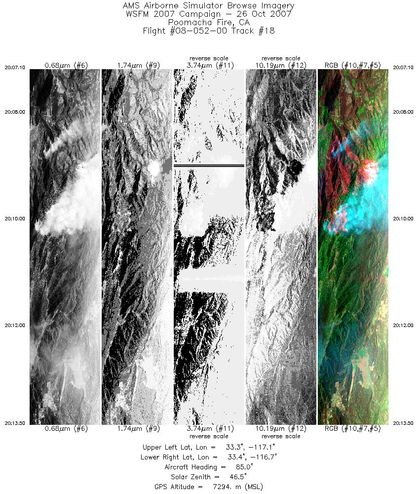
| 18 |
20:07 - 20:13 |
89.5 |
33.376 - 33.384 |
117.074 - 116.732 |
3601 |
7295 |
| 19 |
20:17 - 20:25 |
261.8 |
33.312 - 33.313 |
116.781 - 117.160 |
4494 |
7295 |
| 20 |
20:29 - 20:36 |
93.5 |
33.240 - 33.249 |
117.087 - 116.714 |
3943 |
7295 |
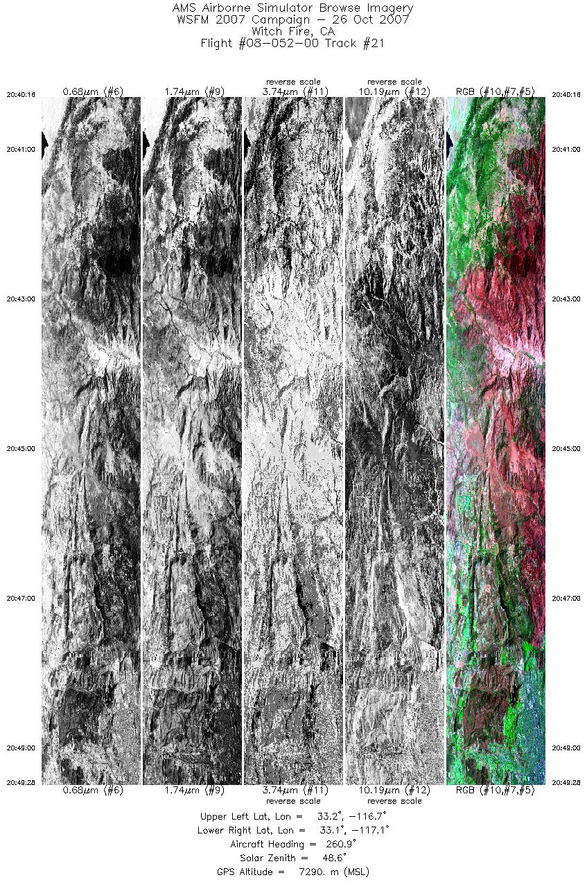
| 21 |
20:40 - 20:49 |
260.8 |
33.179 - 33.178 |
116.706 - 117.097 |
4968 |
7292 |
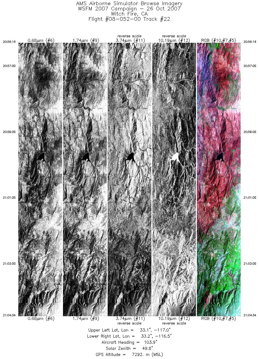
| 22 |
20:56 - 21:04 |
99.4 |
33.110 - 33.113 |
116.958 - 116.549 |
4479 |
7304 |
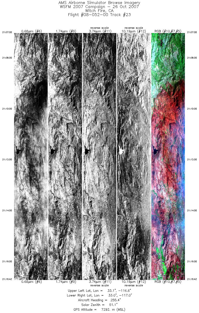
| 23 |
21:07 - 21:16 |
257.9 |
33.069 - 33.071 |
116.573 - 116.991 |
5234 |
7290 |
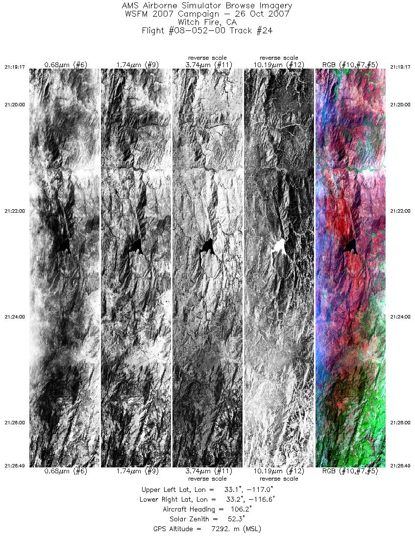
| 24 |
21:19 - 21:26 |
101.3 |
33.111 - 33.112 |
116.955 - 116.586 |
4073 |
7289 |
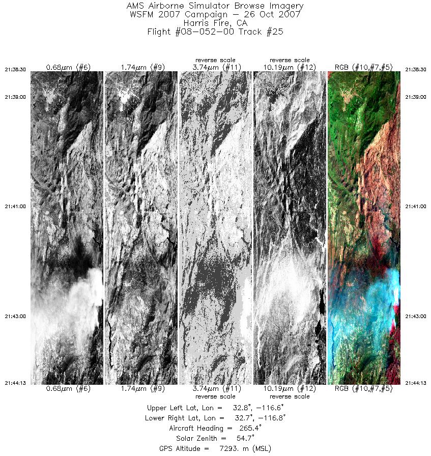
| 25 |
21:38 - 21:44 |
259.8 |
32.752 - 32.739 |
116.545 - 116.789 |
3084 |
7298 |
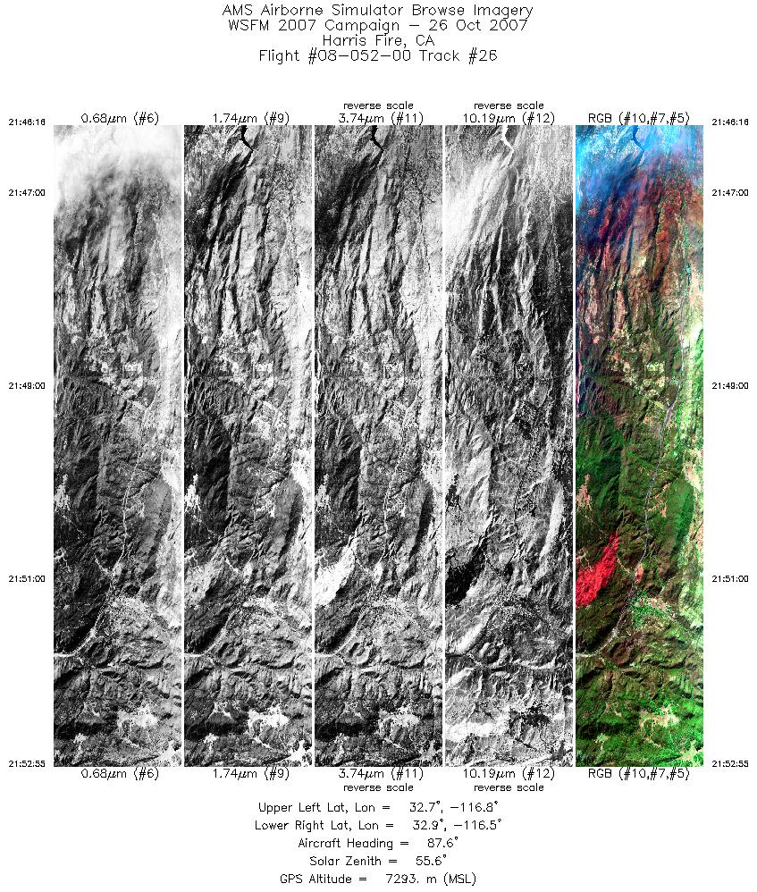
| 26 |
21:46 - 21:52 |
84.4 |
32.790 - 32.840 |
116.776 - 116.449 |
3594 |
7295 |
| 27 |
22:04 - 22:06 |
346.8 |
33.007 - 33.140 |
116.630 - 116.645 |
1272 |
7310 |
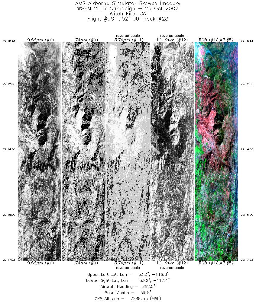
| 28 |
22:10 - 22:17 |
261.0 |
33.246 - 33.249 |
116.805 - 117.093 |
3620 |
7288 |
| 29 |
22:19 - 22:25 |
91.5 |
33.301 - 33.310 |
117.105 - 116.776 |
3509 |
7290 |
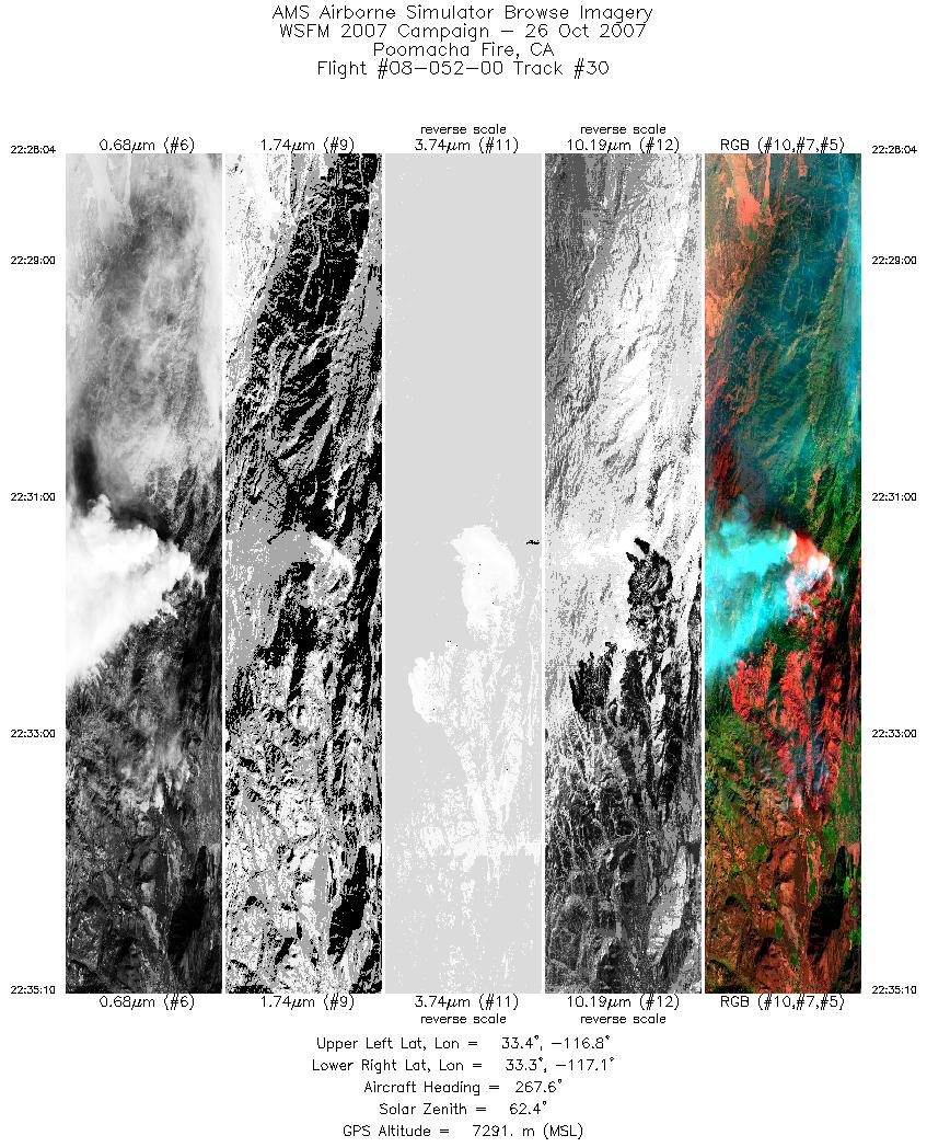
| 30 |
22:28 - 22:35 |
262.9 |
33.373 - 33.375 |
116.756 - 117.075 |
3836 |
7291 |
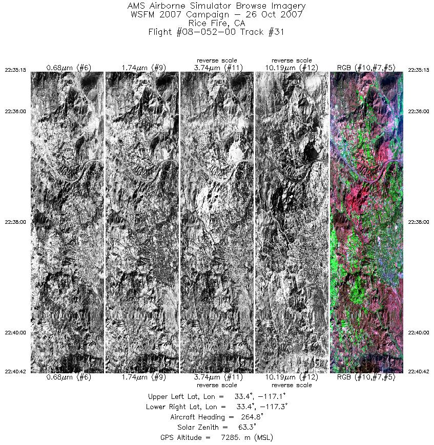
| 31 |
22:35 - 22:40 |
267.0 |
33.375 - 33.421 |
117.079 - 117.335 |
2948 |
7291 |
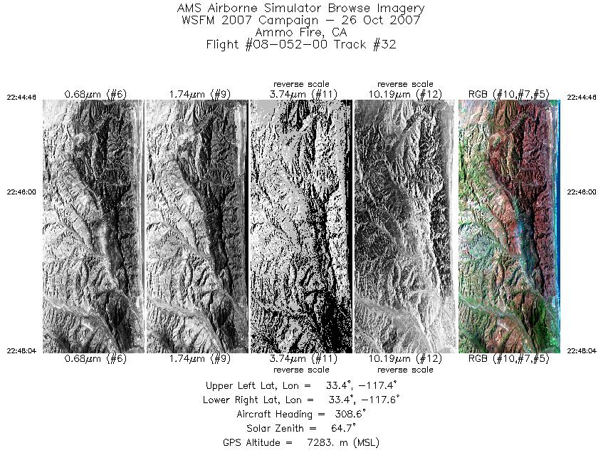
| 32 |
22:44 - 22:48 |
305.7 |
33.331 - 33.437 |
117.417 - 117.544 |
1784 |
7285 |
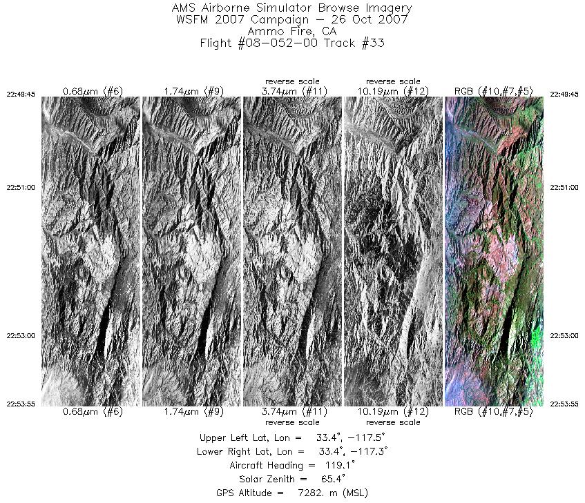
| 33 |
22:49 - 22:53 |
125.7 |
33.483 - 33.401 |
117.510 - 117.350 |
2249 |
7284 |
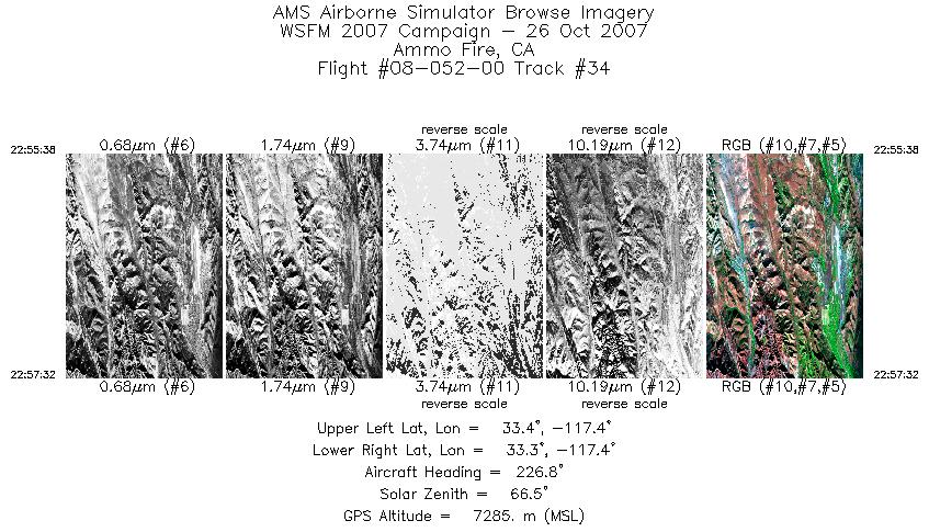
| 34 |
22:55 - 22:57 |
226.8 |
33.348 - 33.310 |
117.350 - 117.411 |
1028 |
7284 |
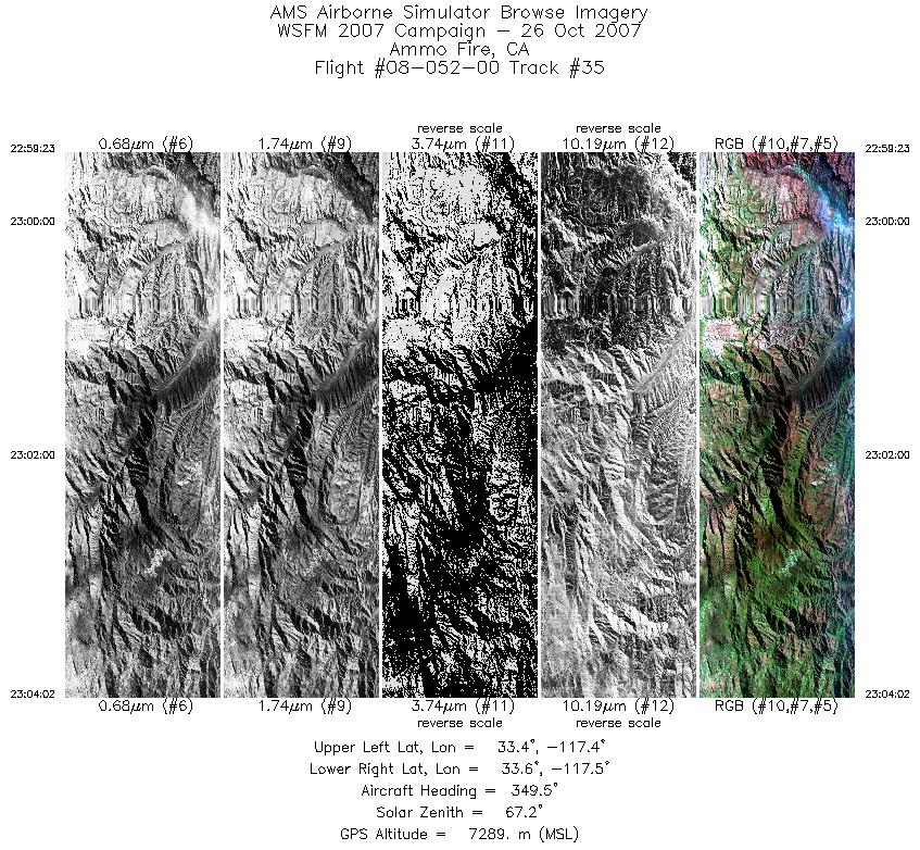
| 35 |
22:59 - 23:04 |
351.4 |
33.366 - 33.622 |
117.460 - 117.464 |
2512 |
7294 |
| 36 |
23:05 - 23:10 |
297.0 |
33.684 - 33.767 |
117.499 - 117.711 |
2685 |
7283 |
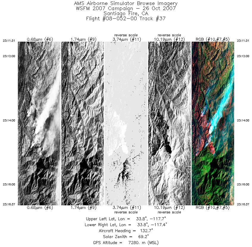
| 37 |
23:11 - 23:16 |
127.9 |
33.798 - 33.704 |
117.694 - 117.487 |
2754 |
7280 |
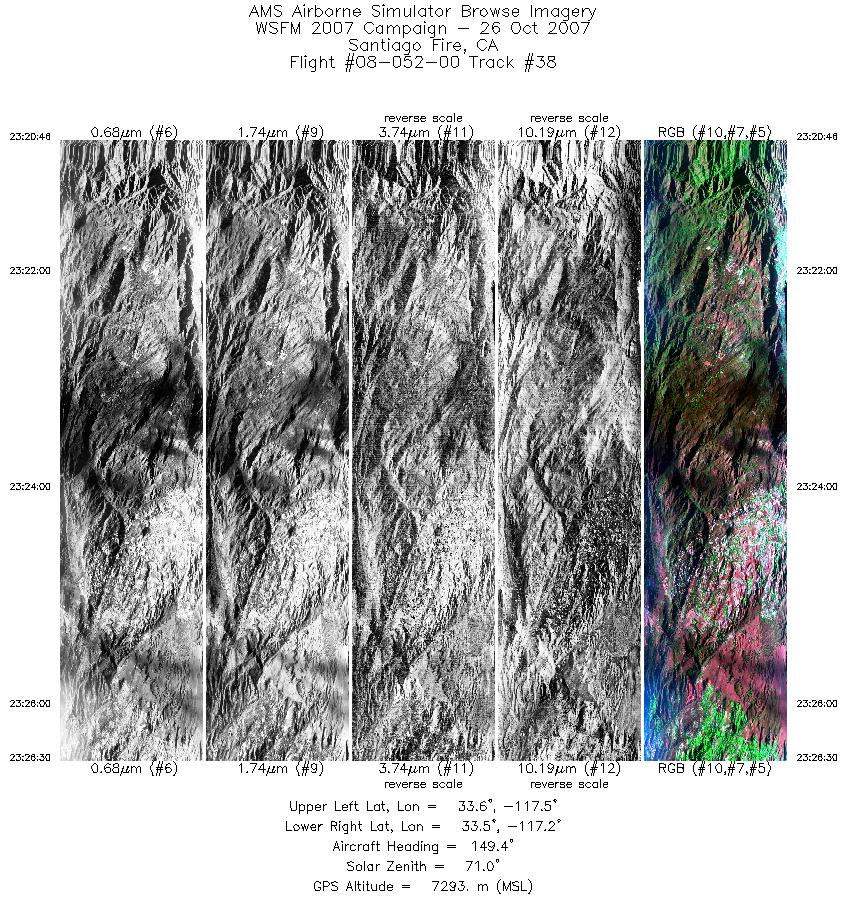
| 38 |
23:20 - 23:26 |
147.4 |
33.678 - 33.485 |
117.479 - 117.273 |
3105 |
7282 |
| 39 |
23:27 - 23:32 |
136.6 |
33.459 - 33.334 |
117.252 - 117.067 |
2709 |
7287 |
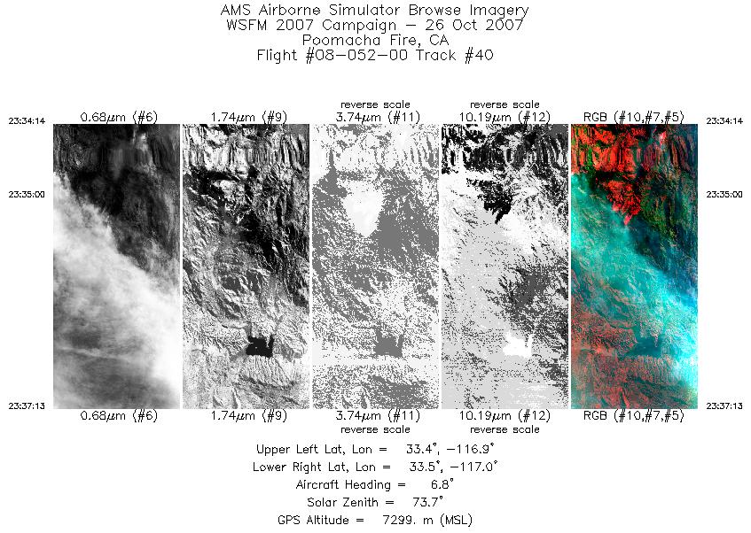
| 40 |
23:34 - 23:37 |
7.2 |
33.354 - 33.526 |
116.984 - 116.946 |
1613 |
7304 |
| 41 |
23:52 - 23:58 |
258.1 |
34.242 - 34.248 |
116.965 - 117.202 |
2929 |
7280 |
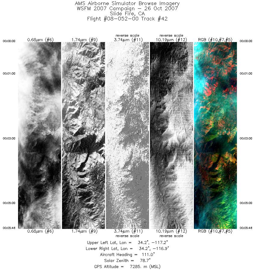
| 42 |
00:00 - 00:05 |
105.3 |
34.206 - 34.192 |
117.188 - 116.889 |
3111 |
7287 |
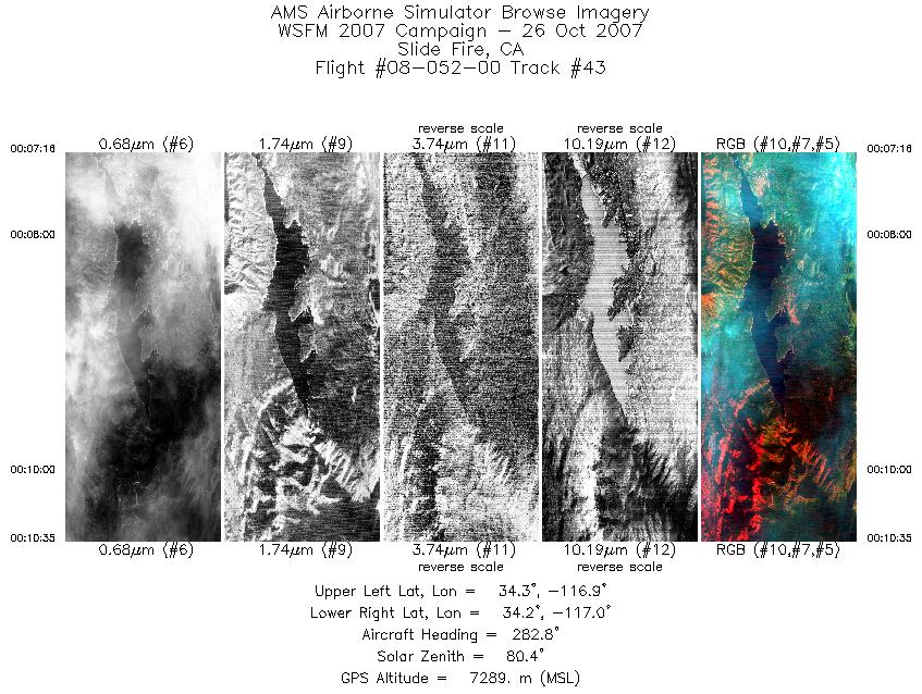
| 43 |
00:07 - 00:10 |
272.5 |
34.239 - 34.247 |
116.873 - 117.020 |
1792 |
7285 |
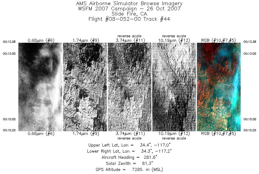
| 44 |
00:12 - 00:15 |
281.7 |
34.319 - 34.359 |
117.054 - 117.169 |
1452 |
7281 |
|


