Flight: 08-051-00
Date: 25 Oct 2007
Location: Southern California Fires
Deployment: WSFM 2007
Configuration: Land 2.5 (12-Channel)
Principal Investigators: Ambrosia (CSUMB)
Additional Sensors: None
|
Fire Coverage
Buckweed / Ranch / Cajon / Grass Valley / Slide / Esperanza
Ammo / Rice / Poomacha / Witch / Harris
|
Data Evaluation
Overall quality is good
|
Processing Information
Level-1B Data in HDF format is available
Flight Line Summary
Spectral Band Configuration
Spectral Response Function Table
Spectral Response Function (text)
|
Browse Imagery
Flight Tracks: 34
Scanlines: 96159
|
Browse Imagery Table
|
Click a Flight Track number to view a quicklook image
Lat/Lon ranges are for the BEG-END scanline nadir pixels
|
Flight
Track |
Time Span
(GMT) |
Heading
(Deg) |
Lat Range
(Deg N) |
Lon Range
(Deg W) |
Length
(Scanlines) |
Altitude
(Meters) |
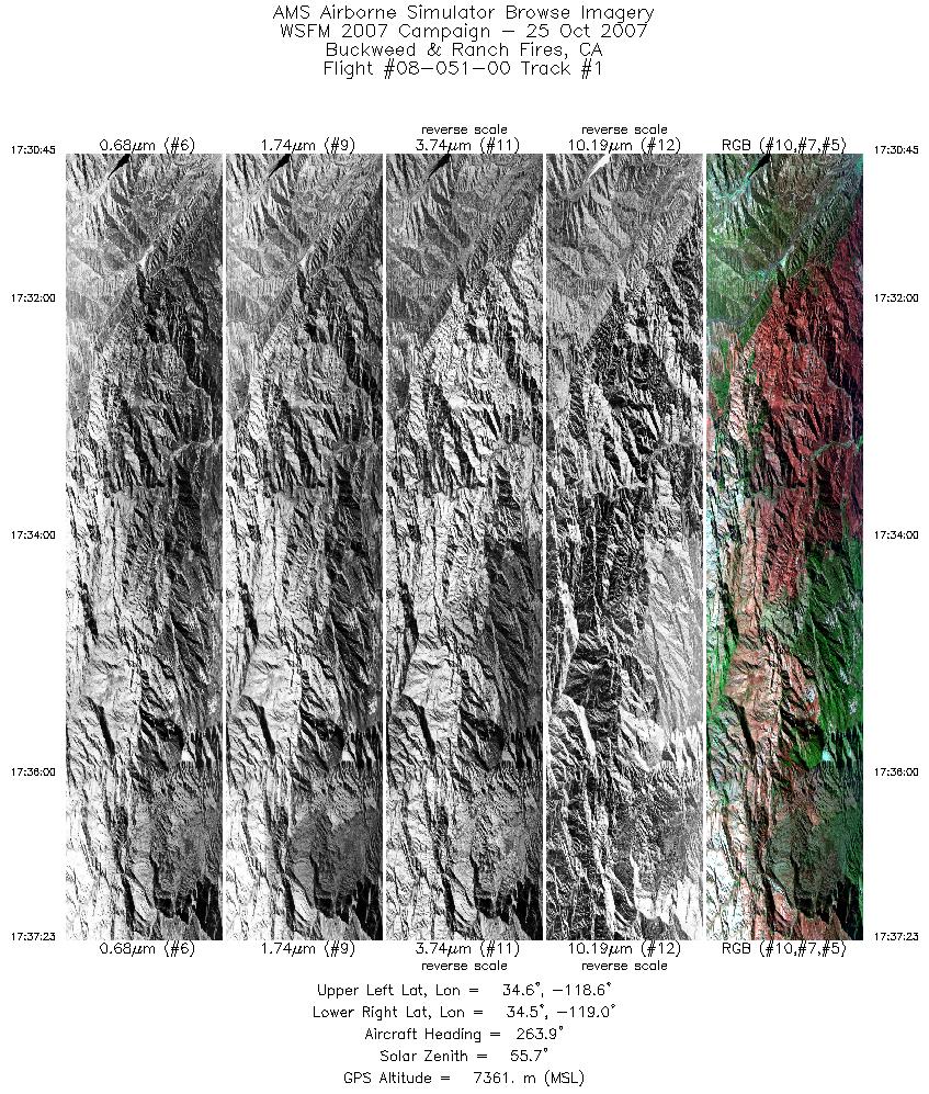
| 1 |
17:30 - 17:37 |
266.0 |
34.566 - 34.565 |
118.638 - 118.951 |
3586 |
7364 |
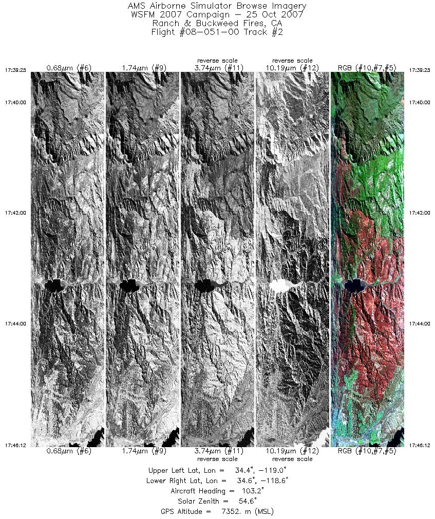
| 2 |
17:39 - 17:46 |
95.8 |
34.506 - 34.496 |
118.950 - 118.615 |
3659 |
7351 |
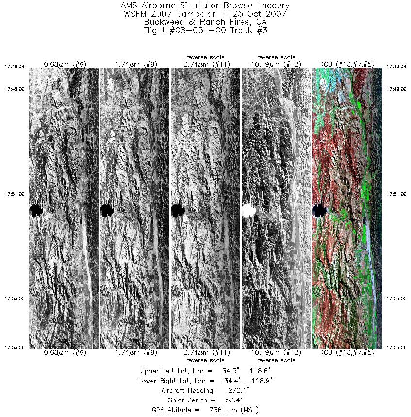
| 3 |
17:48 - 17:53 |
269.7 |
34.424 - 34.429 |
118.617 - 118.873 |
2899 |
7361 |
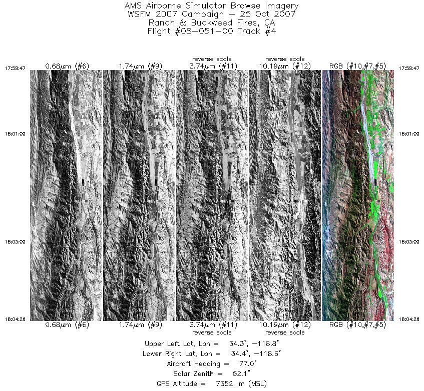
| 4 |
17:59 - 18:04 |
84.0 |
34.377 - 34.379 |
118.871 - 118.638 |
2511 |
7352 |
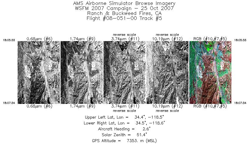
| 5 |
18:05 - 18:07 |
7.8 |
34.423 - 34.495 |
118.611 - 118.582 |
1073 |
7352 |
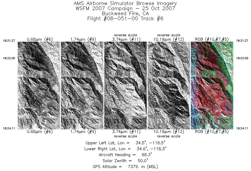
| 6 |
18:21 - 18:24 |
101.9 |
34.548 - 34.509 |
118.524 - 118.338 |
1475 |
7381 |
| 7 |
18:24 - 18:31 |
115.6 |
34.507 - 34.315 |
118.330 - 117.904 |
3759 |
7381 |
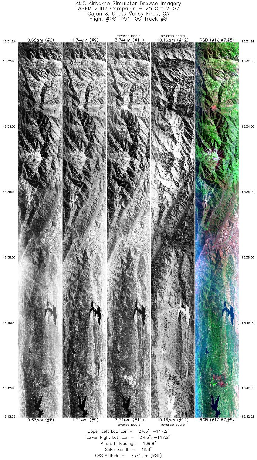
| 8 |
18:31 - 18:42 |
100.6 |
34.312 - 34.262 |
117.896 - 117.172 |
6193 |
7369 |
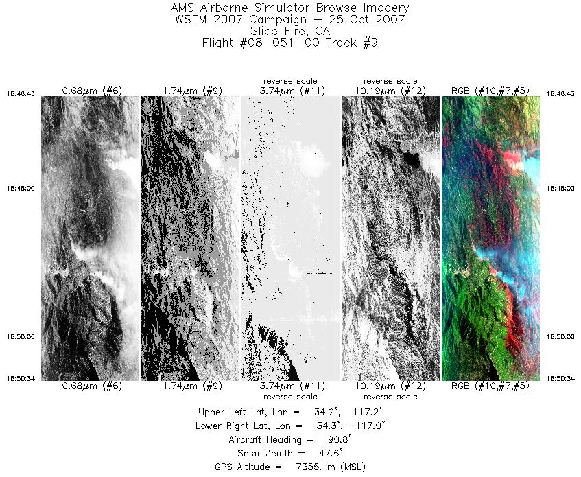
| 9 |
18:46 - 18:50 |
89.8 |
34.241 - 34.243 |
117.159 - 116.967 |
2079 |
7355 |
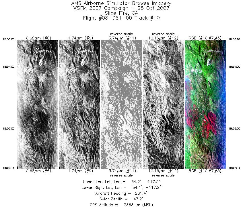
| 10 |
18:53 - 18:57 |
276.1 |
34.190 - 34.203 |
116.987 - 117.184 |
2234 |
7365 |
| 11 |
18:59 - 19:02 |
87.9 |
34.275 - 34.275 |
117.137 - 117.007 |
1288 |
7369 |
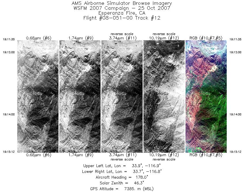
| 12 |
19:11 - 19:15 |
183.0 |
33.929 - 33.737 |
116.795 - 116.813 |
1957 |
7385 |
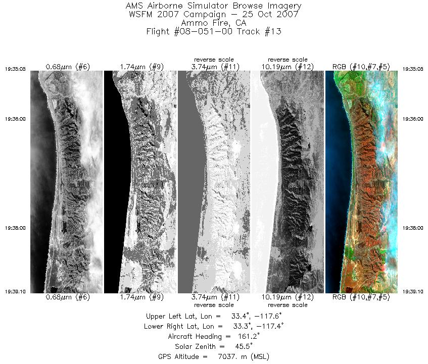
| 13 |
19:35 - 19:39 |
147.0 |
33.411 - 33.291 |
117.554 - 117.422 |
2208 |
7033 |
| 14 |
19:44 - 19:48 |
103.3 |
33.414 - 33.375 |
117.274 - 117.086 |
2217 |
7035 |
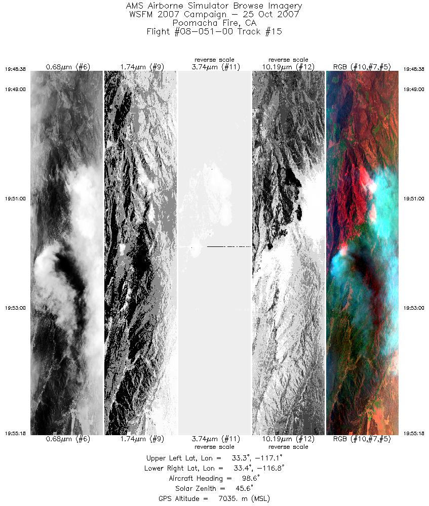
| 15 |
19:48 - 19:55 |
93.6 |
33.375 - 33.376 |
117.083 - 116.771 |
3604 |
7035 |
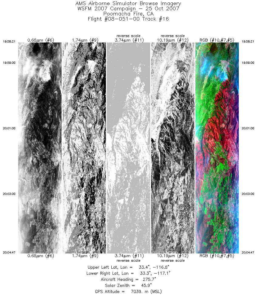
| 16 |
19:58 - 20:04 |
270.7 |
33.306 - 33.307 |
116.781 - 117.083 |
3478 |
7038 |
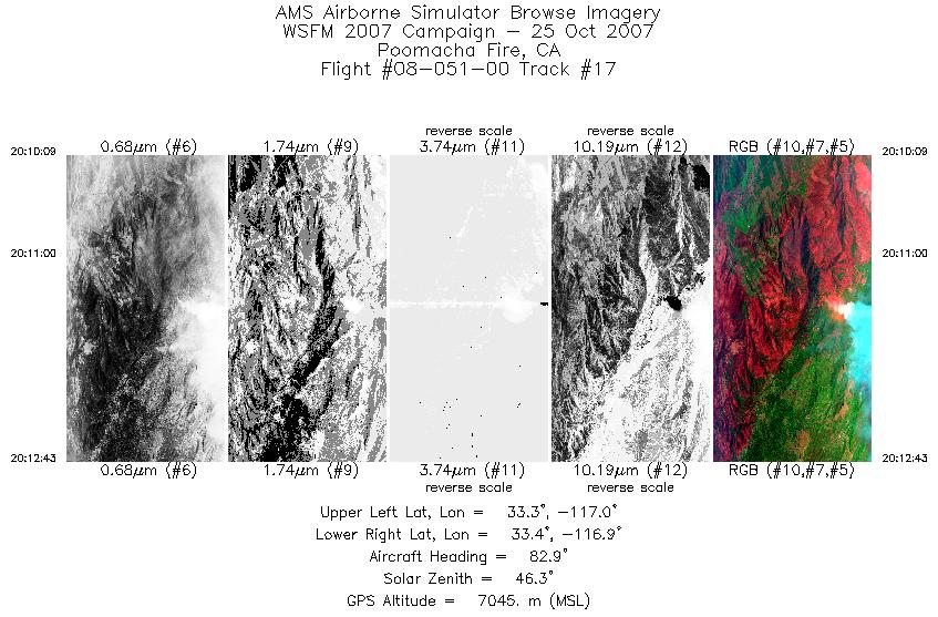
| 17 |
20:10 - 20:12 |
85.8 |
33.329 - 33.333 |
117.000 - 116.856 |
1386 |
7043 |
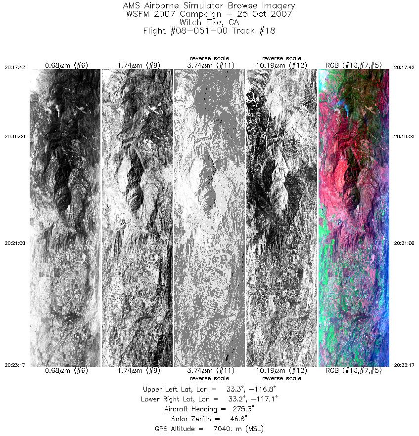
| 18 |
20:17 - 20:23 |
269.7 |
33.253 - 33.246 |
116.809 - 117.084 |
3018 |
7040 |
| 19 |
20:25 - 20:34 |
96.4 |
33.185 - 33.175 |
117.113 - 116.660 |
4912 |
7034 |
| 20 |
20:38 - 20:43 |
265.1 |
33.105 - 33.113 |
116.757 - 116.995 |
2870 |
7033 |
| 21 |
20:45 - 20:52 |
97.4 |
33.055 - 33.033 |
116.983 - 116.652 |
3544 |
7036 |
| 22 |
21:00 - 21:07 |
263.2 |
32.766 - 32.728 |
116.490 - 116.815 |
3891 |
7032 |
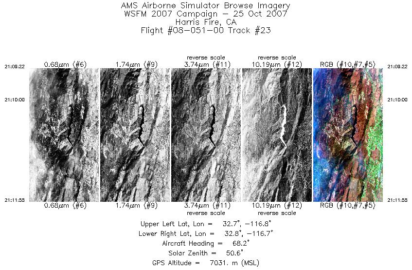
| 23 |
21:09 - 21:11 |
68.2 |
32.763 - 32.796 |
116.827 - 116.711 |
1371 |
7031 |
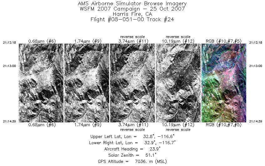
| 24 |
21:12 - 21:14 |
19.8 |
32.806 - 32.908 |
116.697 - 116.655 |
1266 |
7015 |
| 25 |
21:21 - 21:26 |
271.5 |
32.743 - 32.727 |
116.561 - 116.826 |
3056 |
7031 |
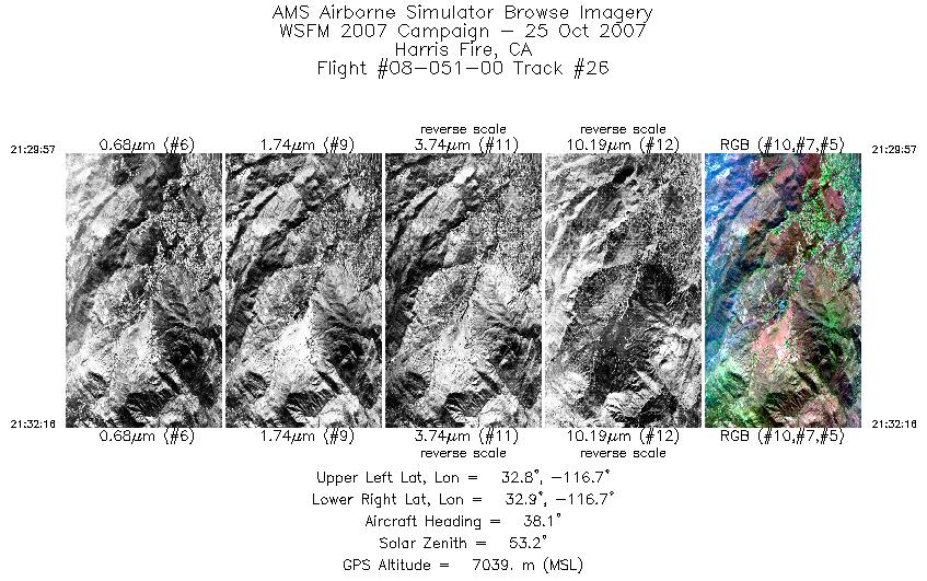
| 26 |
21:29 - 21:32 |
33.2 |
32.787 - 32.882 |
116.750 - 116.675 |
1255 |
7032 |
| 27 |
21:32 - 21:36 |
5.0 |
32.893 - 33.117 |
116.670 - 116.647 |
2283 |
7050 |
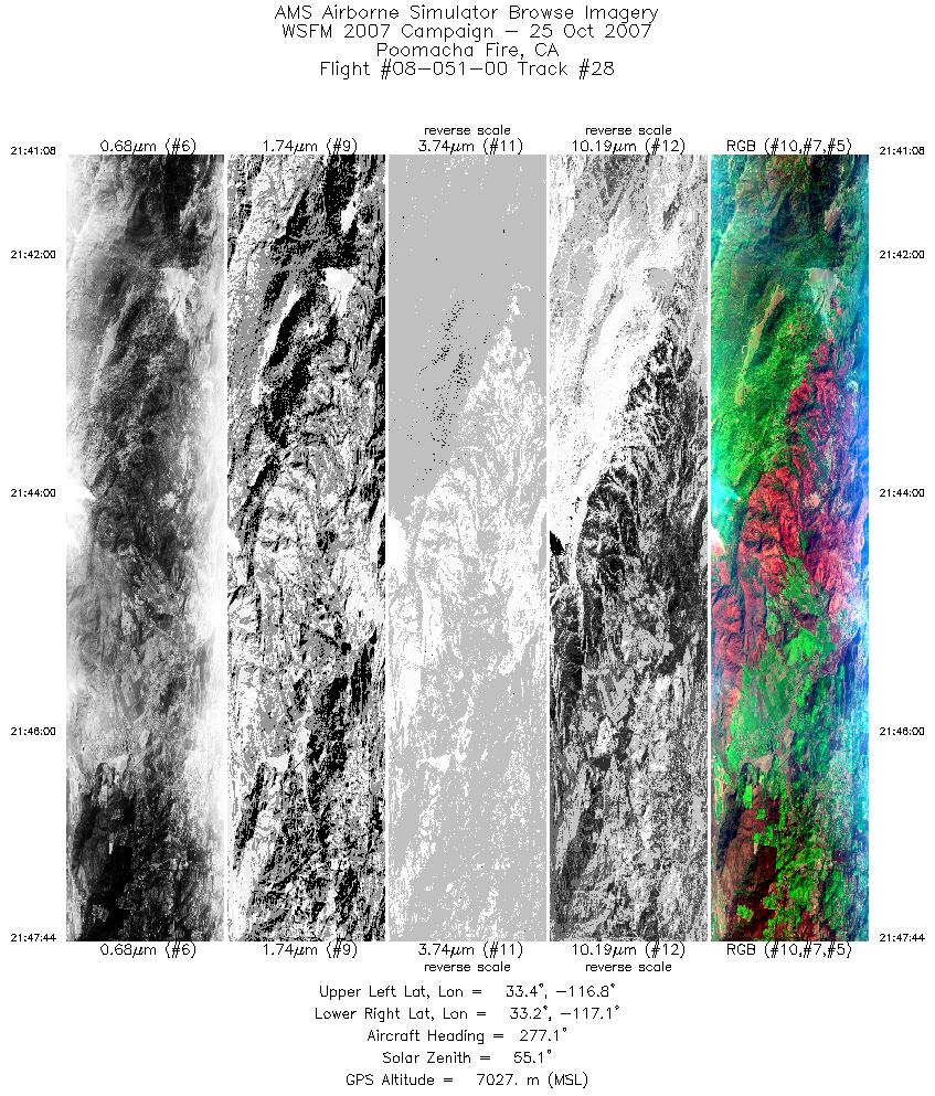
| 28 |
21:41 - 21:47 |
271.9 |
33.306 - 33.307 |
116.759 - 117.081 |
3567 |
7026 |
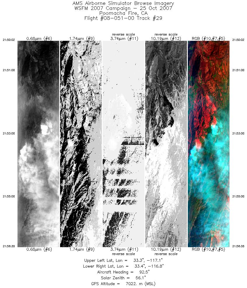
| 29 |
21:50 - 21:56 |
90.1 |
33.380 - 33.378 |
117.091 - 116.767 |
3544 |
7024 |
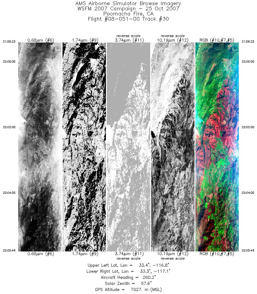
| 30 |
21:59 - 22:05 |
264.1 |
33.313 - 33.309 |
116.783 - 117.090 |
3443 |
7028 |
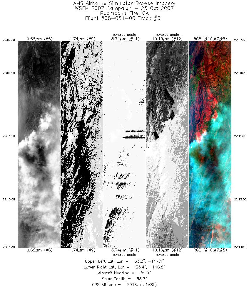
| 31 |
22:07 - 22:14 |
89.0 |
33.374 - 33.379 |
117.077 - 116.754 |
3528 |
7016 |
| 32 |
22:27 - 22:34 |
350.4 |
33.578 - 33.991 |
116.743 - 116.809 |
3857 |
7048 |
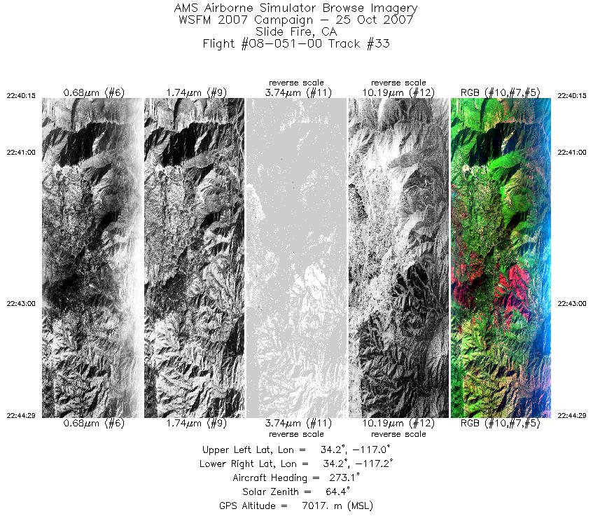
| 33 |
22:40 - 22:44 |
272.9 |
34.190 - 34.204 |
116.990 - 117.193 |
2285 |
7018 |
| 34 |
22:45 - 22:51 |
90.9 |
34.244 - 34.241 |
117.186 - 116.915 |
2863 |
7001 |
|


