Flight: 08-050-00
Date: 24 Oct 2007
Location: Southern California Fires
Deployment: WSFM 2007
Configuration: Land 2.5 (12-Channel)
Principal Investigators: Ambrosia (CSUMB)
Additional Sensors: None
|
Fire Coverage
Harris / Witch / Poomacha / Ammo / Rice / Slide
Cajon / Grass Valley / Buckweed / Ranch / Magic
|
Data Evaluation
Overall quality is good
|
Processing Information
Level-1B Data in HDF format is available
Flight Line Summary
Spectral Band Configuration
Spectral Response Function Table
Spectral Response Function (text)
|
Browse Imagery
Flight Tracks: 33
Scanlines: 114963
|
Browse Imagery Table
|
Click a Flight Track number to view a quicklook image
Lat/Lon ranges are for the BEG-END scanline nadir pixels
|
Flight
Track |
Time Span
(GMT) |
Heading
(Deg) |
Lat Range
(Deg N) |
Lon Range
(Deg W) |
Length
(Scanlines) |
Altitude
(Meters) |
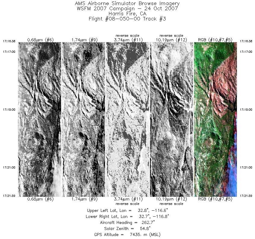
| 1 |
16:59 - 17:04 |
263.6 |
32.746 - 32.724 |
116.612 - 116.843 |
2217 |
7436 |
| 2 |
17:07 - 17:11 |
86.2 |
32.732 - 32.742 |
116.770 - 116.586 |
1908 |
7435 |
| 3 |
17:16 - 17:21 |
264.4 |
32.752 - 32.729 |
116.559 - 116.819 |
2567 |
7438 |
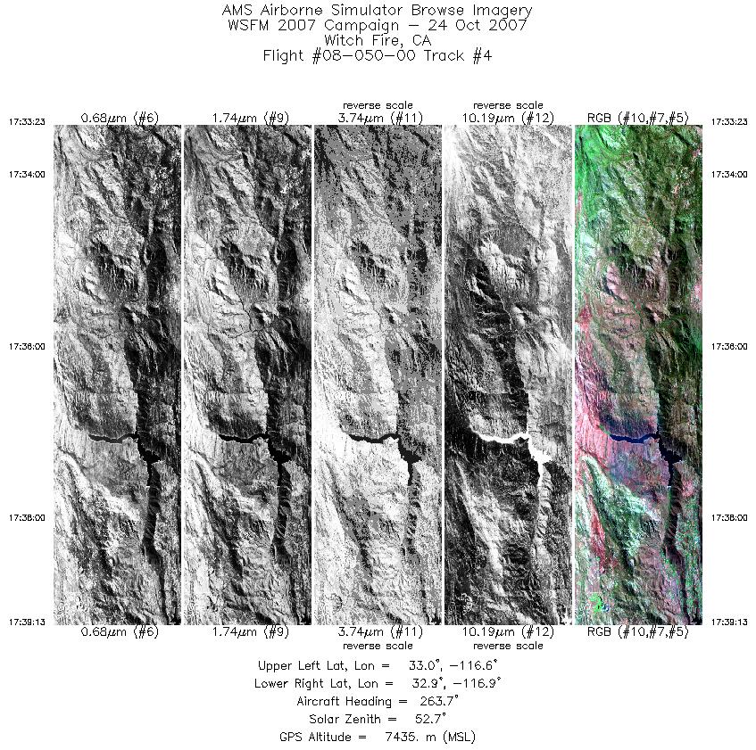
| 4 |
17:33 - 17:39 |
268.3 |
32.907 - 32.911 |
116.594 - 116.881 |
2805 |
7435 |
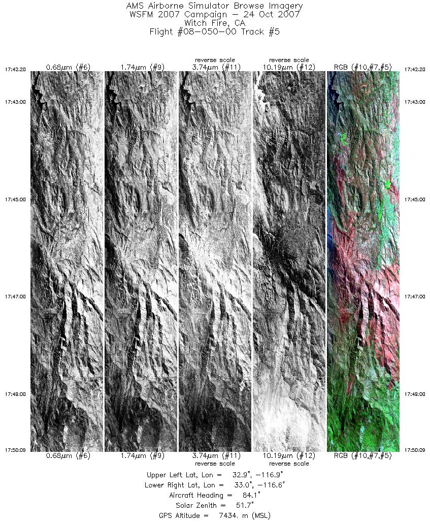
| 5 |
17:42 - 17:50 |
88.0 |
32.971 - 32.971 |
116.948 - 116.589 |
3746 |
7433 |
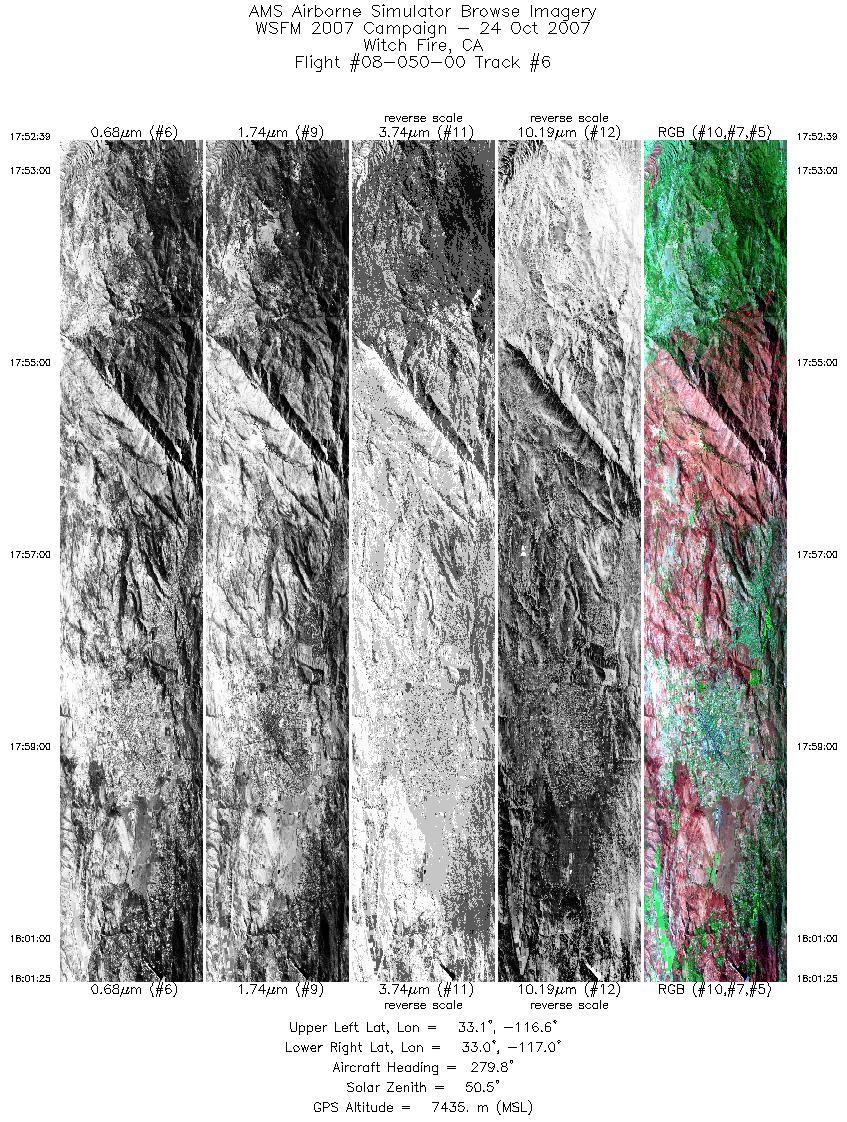
| 6 |
17:52 - 18:01 |
277.2 |
33.040 - 33.045 |
116.557 - 116.992 |
4214 |
7437 |
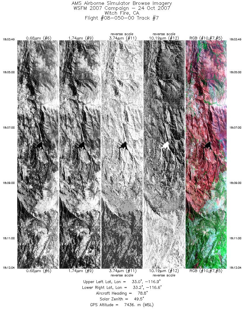
| 7 |
18:03 - 18:12 |
80.1 |
33.106 - 33.108 |
116.966 - 116.584 |
3960 |
7436 |
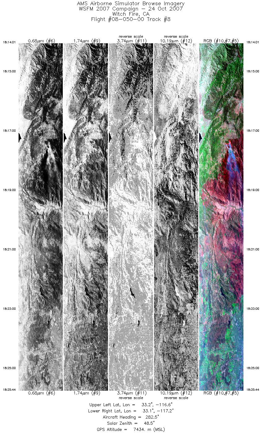
| 8 |
18:14 - 18:25 |
276.3 |
33.170 - 33.182 |
116.574 - 117.149 |
5623 |
7434 |
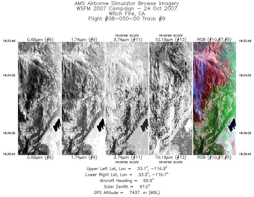
| 9 |
18:32 - 18:36 |
83.1 |
33.175 - 33.201 |
116.888 - 116.694 |
1892 |
7439 |
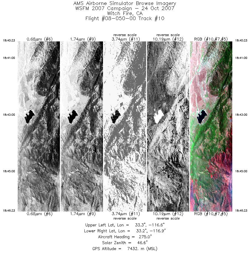
| 10 |
18:40 - 18:46 |
270.6 |
33.215 - 33.212 |
116.610 - 116.912 |
2878 |
7433 |
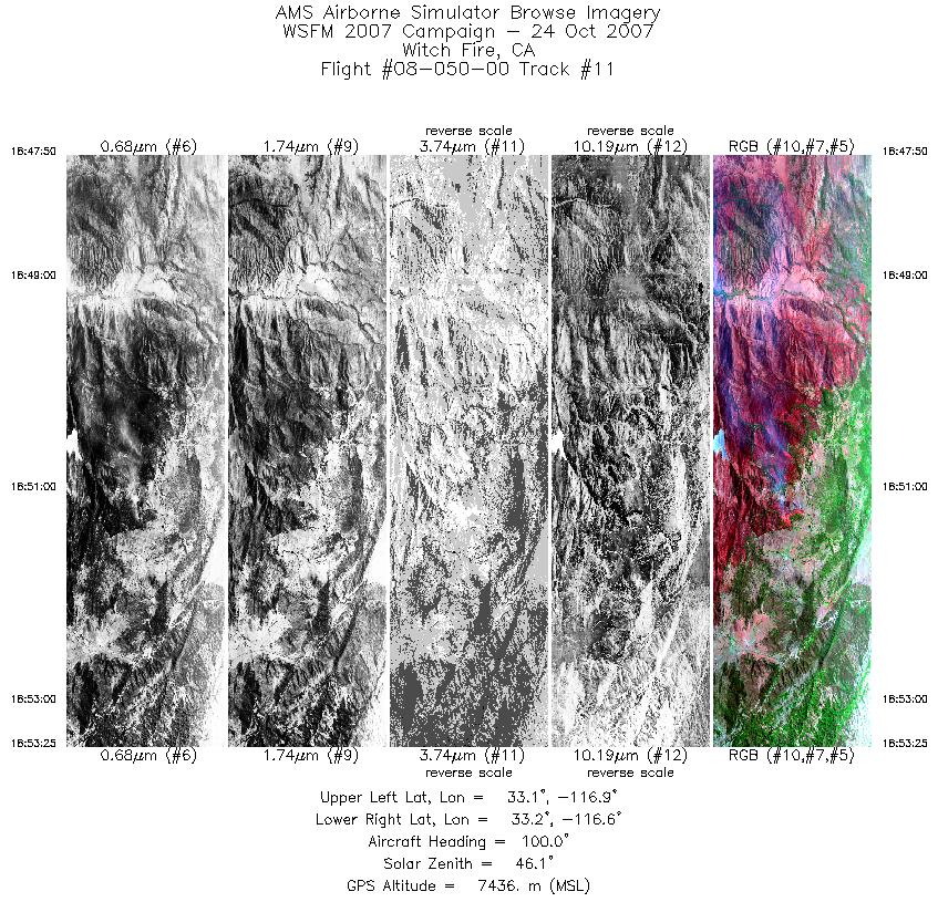
| 11 |
18:47 - 18:53 |
95.3 |
33.171 - 33.162 |
116.918 - 116.634 |
2678 |
7439 |
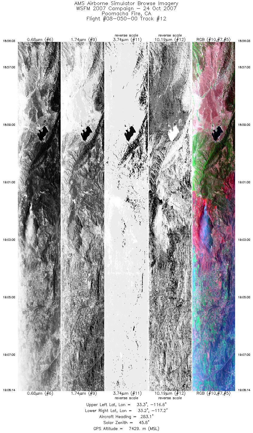
| 12 |
18:56 - 19:08 |
277.8 |
33.241 - 33.243 |
116.591 - 117.174 |
5833 |
7428 |
| 13 |
19:11 - 19:18 |
90.0 |
33.302 - 33.315 |
117.138 - 116.793 |
3651 |
7432 |
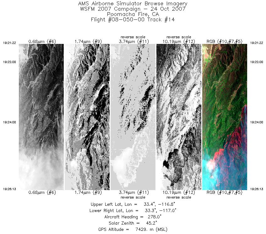
| 14 |
19:21 - 19:26 |
276.2 |
33.352 - 33.348 |
116.755 - 116.995 |
2330 |
7428 |
| 15 |
19:30 - 19:32 |
91.5 |
33.285 - 33.282 |
116.900 - 116.773 |
1300 |
7430 |
| 16 |
19:35 - 19:46 |
263.9 |
33.351 - 33.349 |
116.792 - 117.310 |
5082 |
7427 |
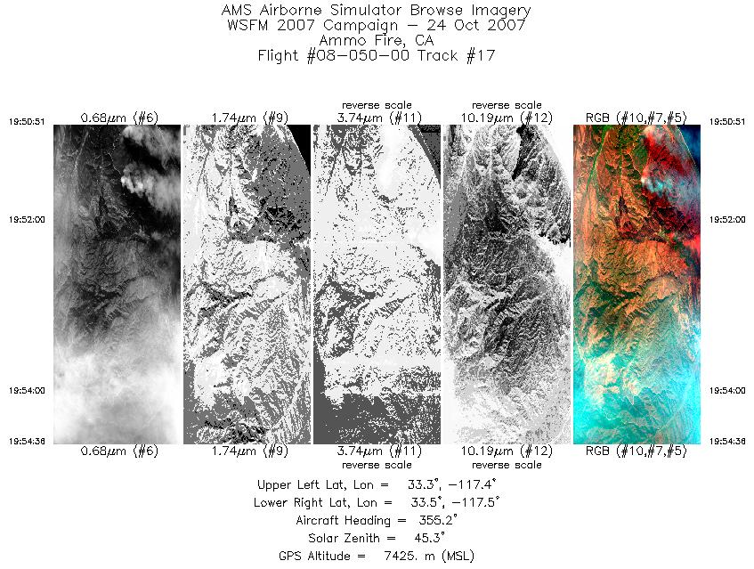
| 17 |
19:50 - 19:54 |
356.7 |
33.319 - 33.474 |
117.454 - 117.451 |
1795 |
7421 |
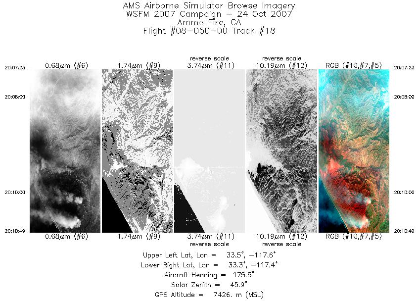
| 18 |
20:07 - 20:10 |
177.1 |
33.473 - 33.322 |
117.485 - 117.482 |
1650 |
7424 |
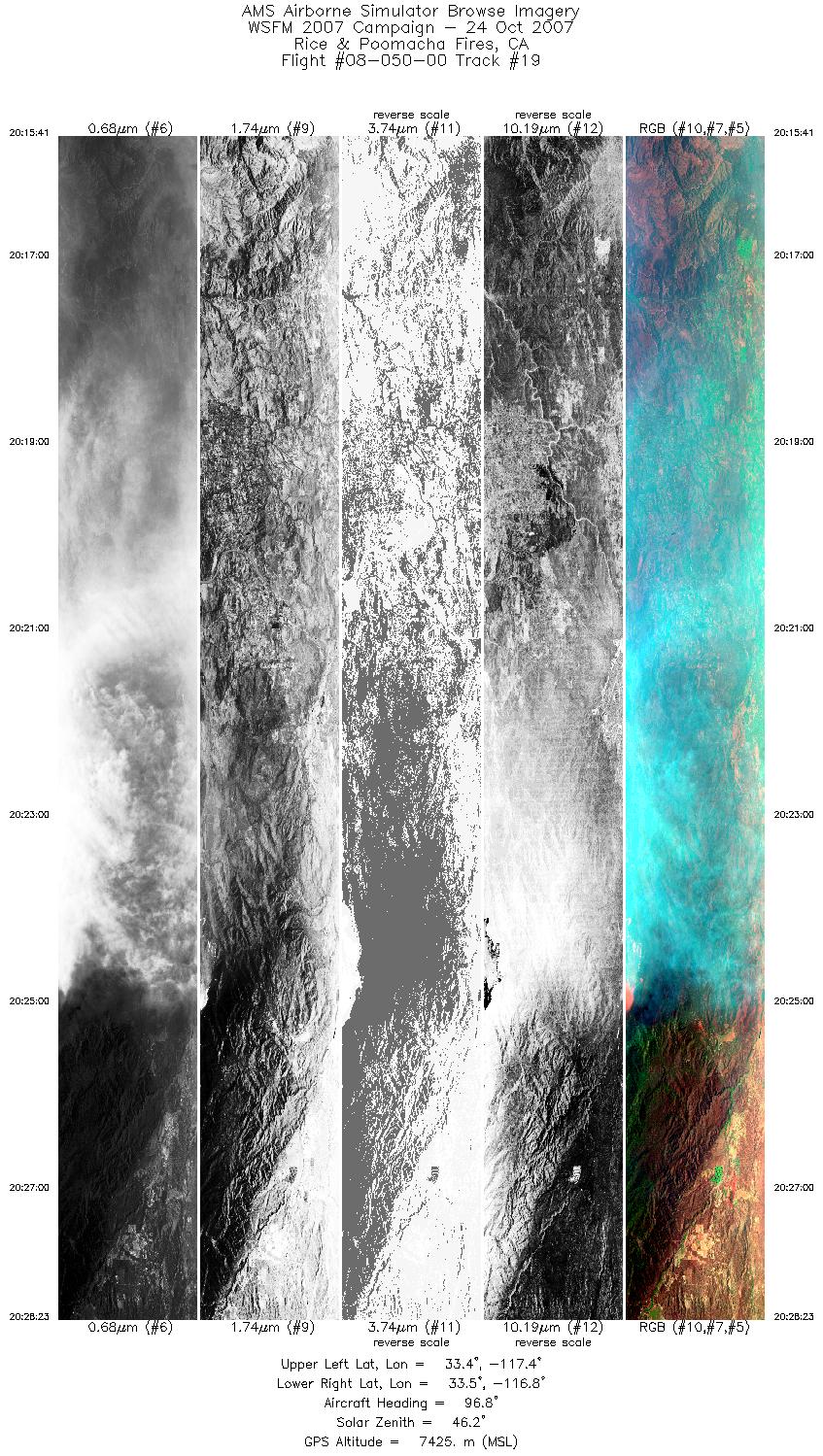
| 19 |
20:15 - 20:28 |
92.2 |
33.423 - 33.423 |
117.417 - 116.796 |
6096 |
7426 |
| 20 |
20:56 - 20:59 |
266.9 |
34.141 - 34.142 |
116.994 - 117.146 |
1412 |
7424 |
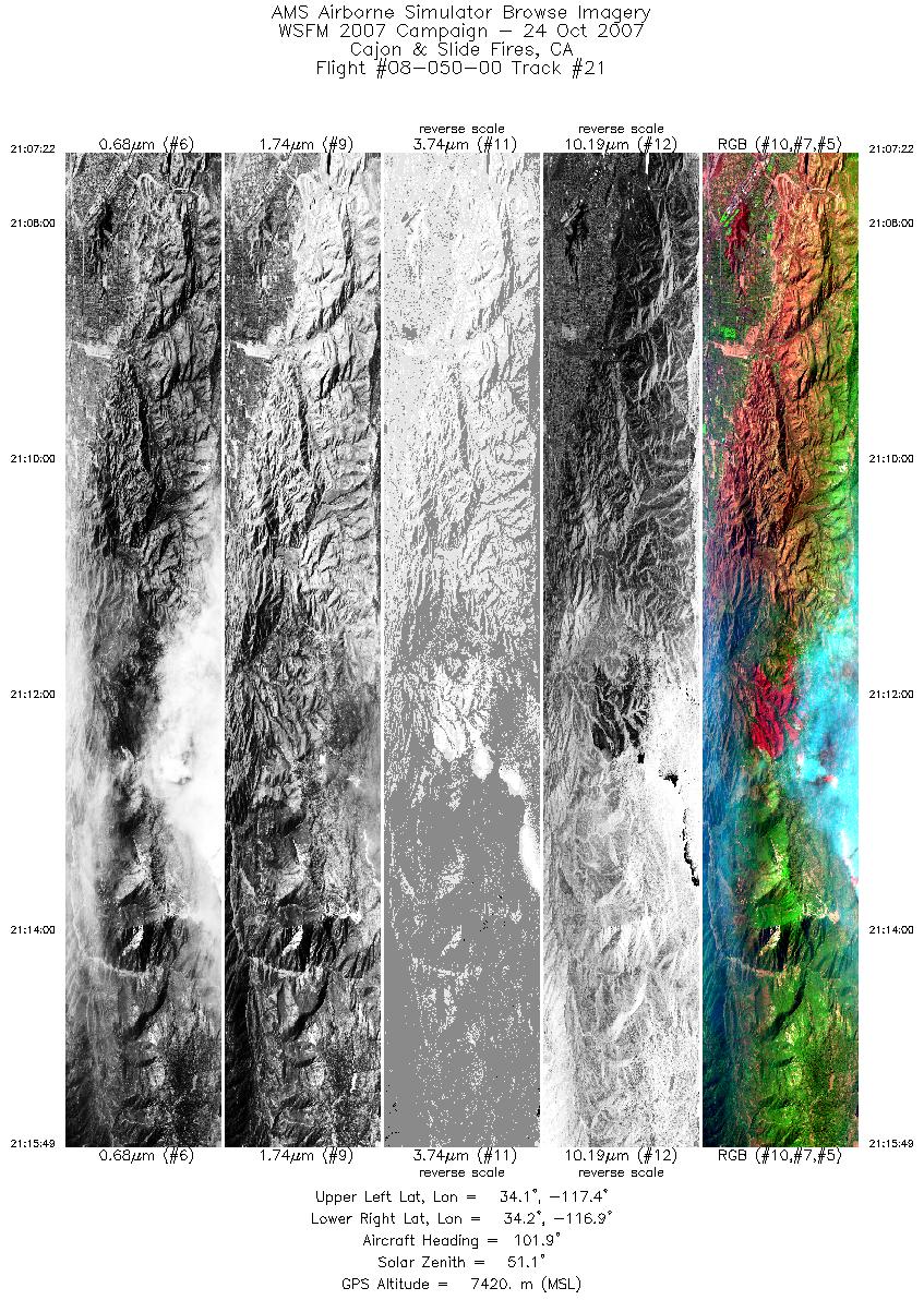
| 21 |
21:07 - 21:15 |
95.1 |
34.190 - 34.196 |
117.355 - 116.941 |
4564 |
7421 |
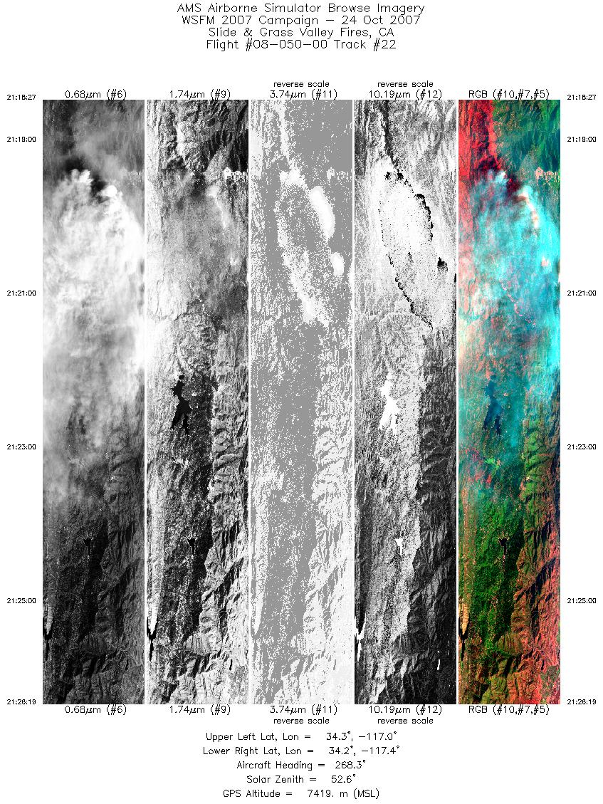
| 22 |
21:18 - 21:26 |
267.9 |
34.241 - 34.236 |
116.984 - 117.366 |
4249 |
7422 |
| 23 |
21:28 - 21:36 |
88.5 |
34.291 - 34.294 |
117.329 - 116.978 |
3951 |
7416 |
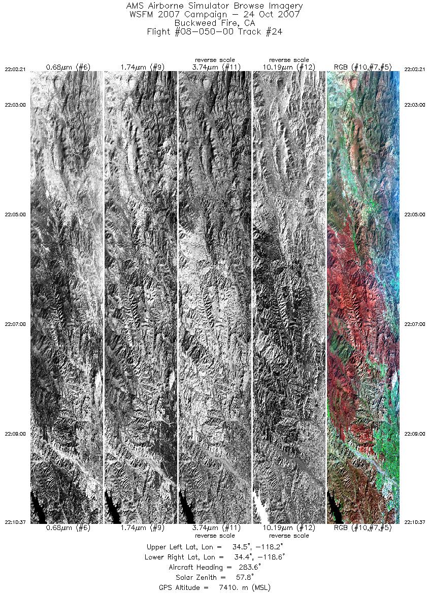
| 24 |
22:02 - 22:10 |
274.8 |
34.491 - 34.491 |
118.213 - 118.594 |
4462 |
7409 |
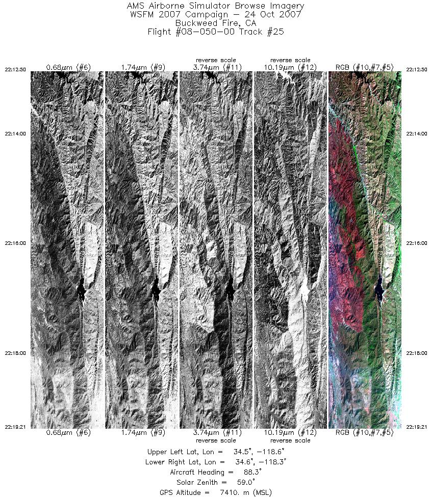
| 25 |
22:12 - 22:19 |
90.8 |
34.555 - 34.561 |
118.588 - 118.261 |
3513 |
7411 |
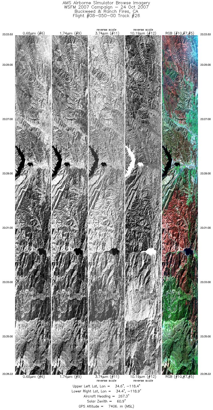
| 26 |
22:23 - 22:36 |
266.8 |
34.499 - 34.493 |
118.380 - 118.950 |
6754 |
7403 |
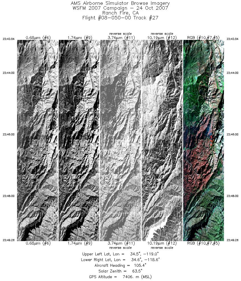
| 27 |
22:42 - 22:49 |
100.8 |
34.568 - 34.566 |
118.948 - 118.611 |
3533 |
7409 |
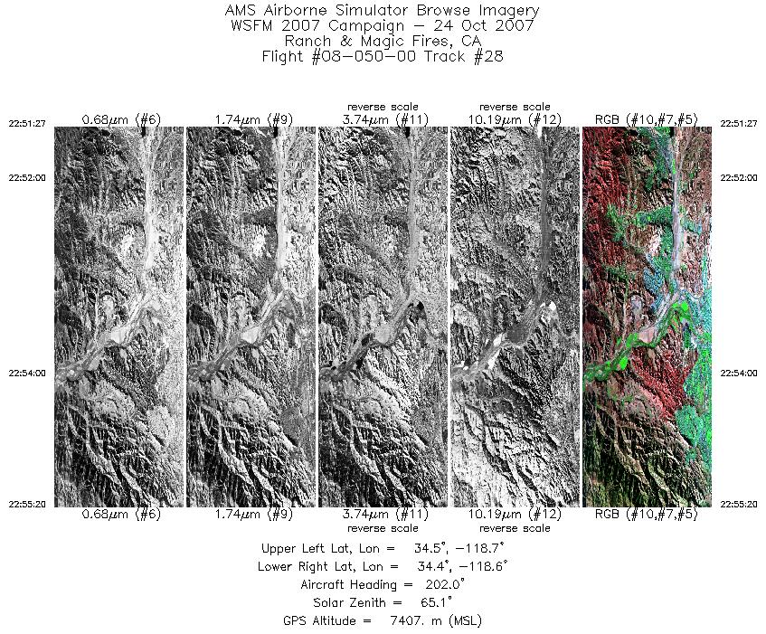
| 28 |
22:51 - 22:55 |
189.3 |
34.511 - 34.355 |
118.629 - 118.627 |
2106 |
7407 |
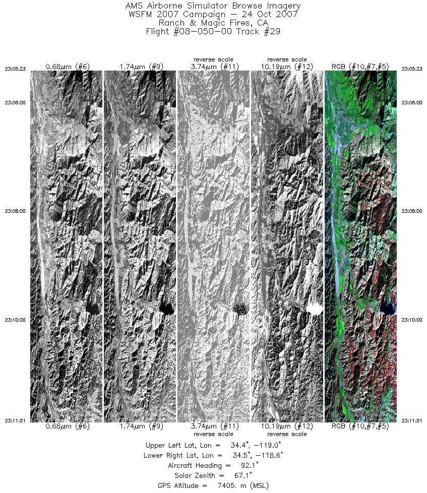
| 29 |
23:05 - 23:11 |
91.7 |
34.429 - 34.434 |
118.984 - 118.650 |
3493 |
7404 |
| 30 |
23:13 - 23:21 |
266.4 |
34.382 - 34.371 |
118.646 - 118.985 |
4087 |
7410 |
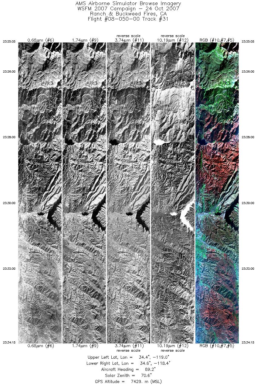
| 31 |
23:25 - 23:34 |
87.9 |
34.506 - 34.515 |
118.965 - 118.353 |
4956 |
7425 |
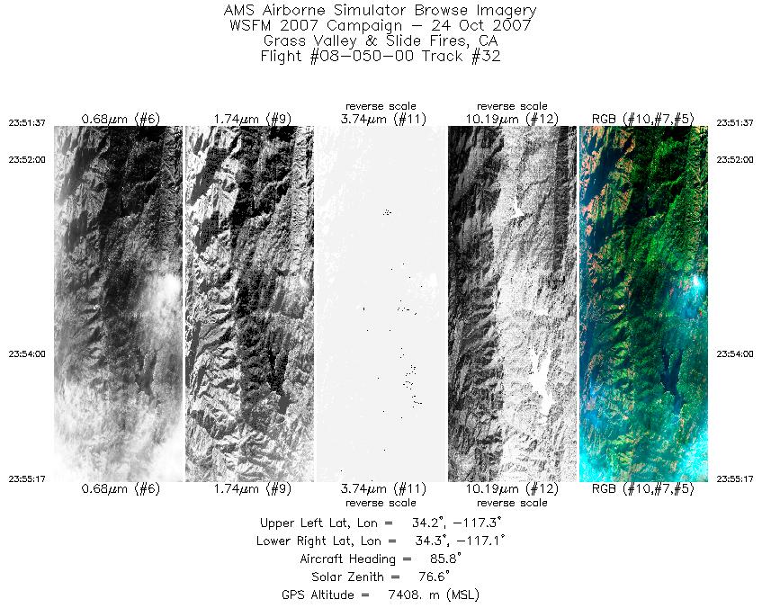
| 32 |
23:51 - 23:55 |
88.0 |
34.240 - 34.240 |
117.315 - 117.139 |
1981 |
7401 |
| 33 |
23:55 - 00:02 |
76.8 |
34.241 - 34.334 |
117.134 - 116.767 |
3677 |
7416 |
|


