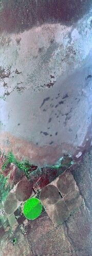
Flight: 07-045-00
Date: 19 Sep 2007
Location: Southern California
Deployment: WSFM 2007
Configuration: Land 2.5 (12-Channel)
Principal Investigators: Ambrosia (CSUMB)
Additional Sensors: None
|
Data Evaluation
Overall quality is good
|
Processing Information
Level-1B Data in HDF format is available
Flight Line Summary
Spectral Band Configuration
Spectral Response Function Table
Spectral Response Function (text)
|
Browse Imagery
Flight Tracks: 18
Scanlines: 49718
|
Browse Imagery Table
|
Click a Flight Track number to view a quicklook image
Lat/Lon ranges are for the BEG-END scanline nadir pixels
|
Flight
Track |
Time Span
(GMT) |
Heading
(Deg) |
Lat Range
(Deg N) |
Lon Range
(Deg W) |
Length
(Scanlines) |
Altitude
(Meters) |
| 1 |
13:22 - 13:29 |
91.9 |
34.952 - 34.945 |
117.589 - 117.258 |
4334 |
3142 |
| 2 |
13:31 - 13:33 |
274.7 |
35.003 - 35.013 |
117.233 - 117.295 |
1222 |
3141 |
| 3 |
13:33 - 13:37 |
261.0 |
35.013 - 34.998 |
117.297 - 117.447 |
2979 |
3148 |
| 4 |
13:38 - 13:40 |
193.5 |
34.991 - 34.928 |
117.455 - 117.454 |
1359 |
3142 |
| 5 |
13:40 - 13:42 |
84.1 |
34.917 - 34.929 |
117.437 - 117.361 |
1010 |
3154 |
| 6 |
13:42 - 13:44 |
93.3 |
34.930 - 34.927 |
117.355 - 117.265 |
1197 |
3149 |
| 7 |
13:47 - 13:48 |
273.7 |
34.992 - 35.000 |
117.288 - 117.351 |
1225 |
3142 |
| 8 |
13:48 - 13:52 |
256.4 |
35.000 - 34.981 |
117.353 - 117.452 |
2000 |
3144 |
| 9 |
13:52 - 13:54 |
178.0 |
34.971 - 34.917 |
117.458 - 117.439 |
1122 |
3144 |
| 10 |
13:54 - 13:56 |
78.2 |
34.909 - 34.929 |
117.403 - 117.318 |
1122 |
3140 |
| 11 |
13:56 - 14:02 |
38.1 |
34.933 - 35.115 |
117.308 - 117.125 |
3643 |
3145 |
| 12 |
14:02 - 14:04 |
50.8 |
35.119 - 35.170 |
117.119 - 117.025 |
1407 |
3143 |
| 13 |
14:08 - 14:10 |
246.5 |
35.237 - 35.215 |
117.099 - 117.160 |
1314 |
3143 |
| 14 |
14:10 - 14:19 |
221.4 |
35.213 - 34.991 |
117.163 - 117.321 |
5955 |
3143 |
| 15 |
14:20 - 14:28 |
43.9 |
34.990 - 35.212 |
117.268 - 116.992 |
4834 |
3142 |
| 16 |
14:28 - 14:33 |
276.4 |
35.232 - 35.255 |
116.994 - 117.174 |
3460 |
3036 |
| 17 |
14:34 - 14:49 |
248.6 |
35.255 - 35.048 |
117.177 - 117.603 |
9999 |
2469 |
| 18 |
14:49 - 14:51 |
239.3 |
35.048 - 35.013 |
117.603 - 117.671 |
1536 |
1908 |
|


