Flight: 07-044-00
Date: 08 Sep 2007
Location: Western USA Fires (day / night)
Deployment: WSFM 2007
Configuration: Land 2.5 (12-Channel)
Principal Investigators: Ambrosia (CSUMB)
Additional Sensors: None
|
Fire Coverage
GW (OR) / Big Basin (OR) / Domke Lake (WA) / North (CA) / Fairmont (CA)
Grouse / Lick (CA) / Middle T (CA) / Moonlight (CA) / Zaca (CA)
|
Data Evaluation
Overall quality is good
|
Processing Information
Level-1B Data in HDF format is available
Flight Line Summary
Spectral Band Configuration
Spectral Response Function Table
Spectral Response Function (text)
|
Browse Imagery
Flight Tracks: 31
Scanlines: 100079
|
Browse Imagery Table
|
Click a Flight Track number to view a quicklook image
Lat/Lon ranges are for the BEG-END scanline nadir pixels
|
Flight
Track |
Time Span
(GMT) |
Heading
(Deg) |
Lat Range
(Deg N) |
Lon Range
(Deg W) |
Length
(Scanlines) |
Altitude
(Meters) |
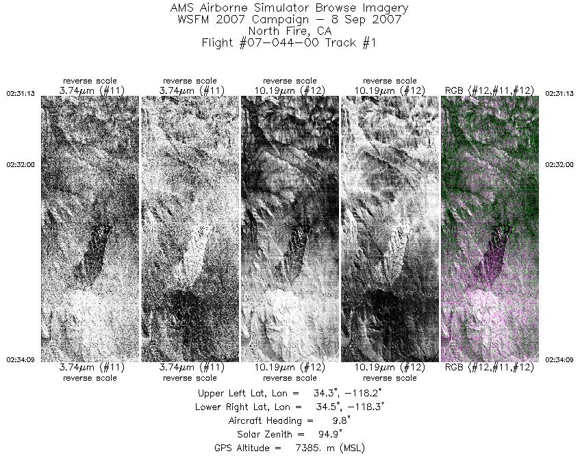
| 1 |
02:31 - 02:34 |
3.5 |
34.321 - 34.476 |
118.254 - 118.245 |
1946 |
7386 |
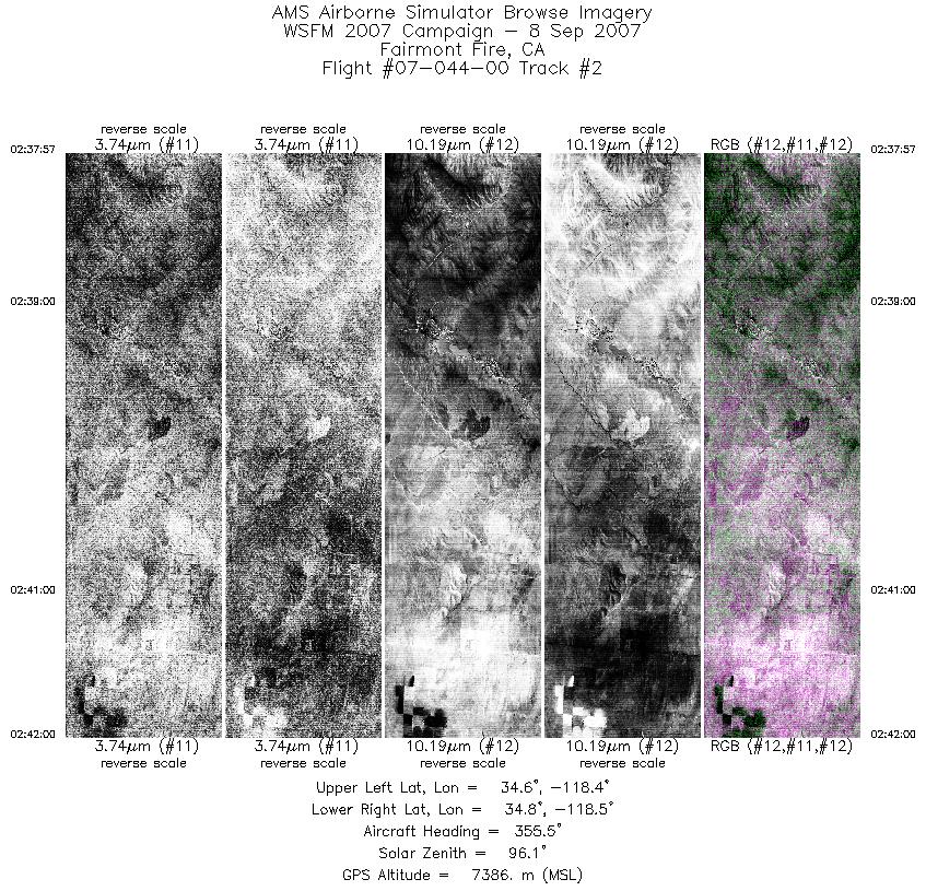
| 2 |
02:37 - 02:42 |
356.5 |
34.592 - 34.804 |
118.412 - 118.418 |
2676 |
7387 |
| 3 |
03:12 - 03:15 |
271.0 |
36.278 - 36.296 |
118.340 - 118.500 |
1865 |
7386 |
| 4 |
04:25 - 04:30 |
259.3 |
37.091 - 37.109 |
121.193 - 121.519 |
2624 |
7038 |
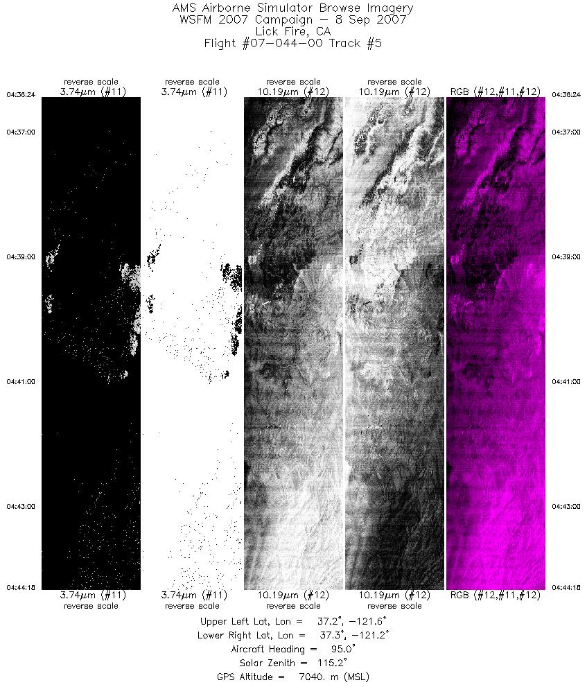
| 5 |
04:36 - 04:44 |
94.2 |
37.223 - 37.226 |
121.588 - 121.188 |
3555 |
7039 |
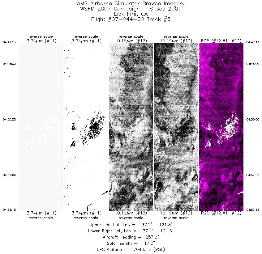
| 6 |
04:47 - 04:53 |
259.4 |
37.155 - 37.158 |
121.237 - 121.587 |
2710 |
7039 |
| 7 |
04:57 - 05:03 |
91.6 |
37.289 - 37.282 |
121.604 - 121.267 |
2920 |
7040 |
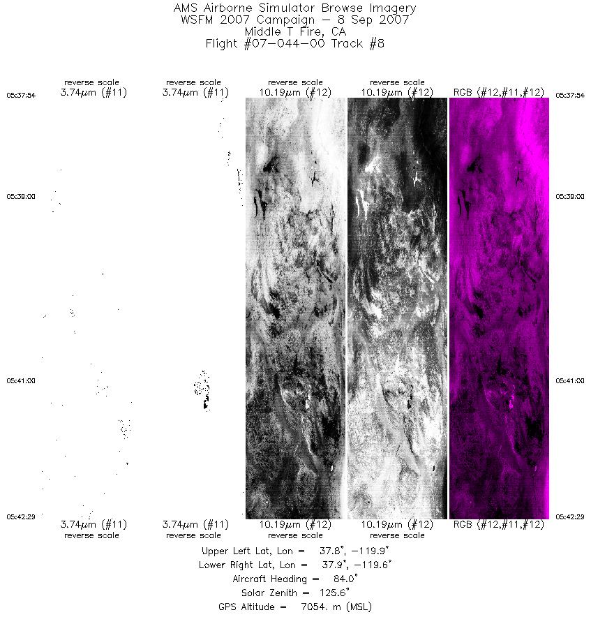
| 8 |
05:37 - 05:42 |
89.6 |
37.863 - 37.871 |
119.903 - 119.651 |
3024 |
7048 |
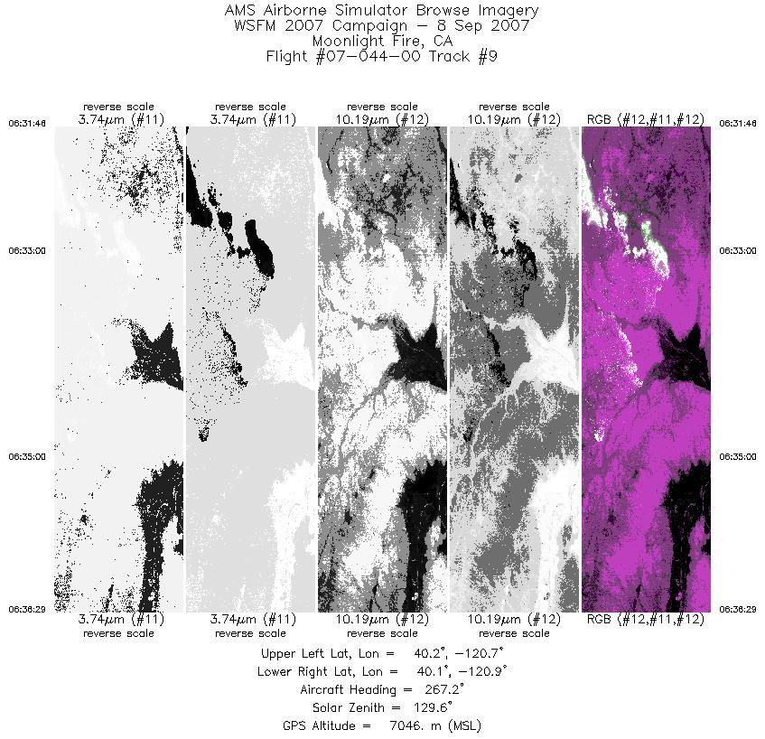
| 9 |
06:31 - 06:36 |
267.4 |
40.155 - 40.162 |
120.690 - 120.931 |
2691 |
7052 |
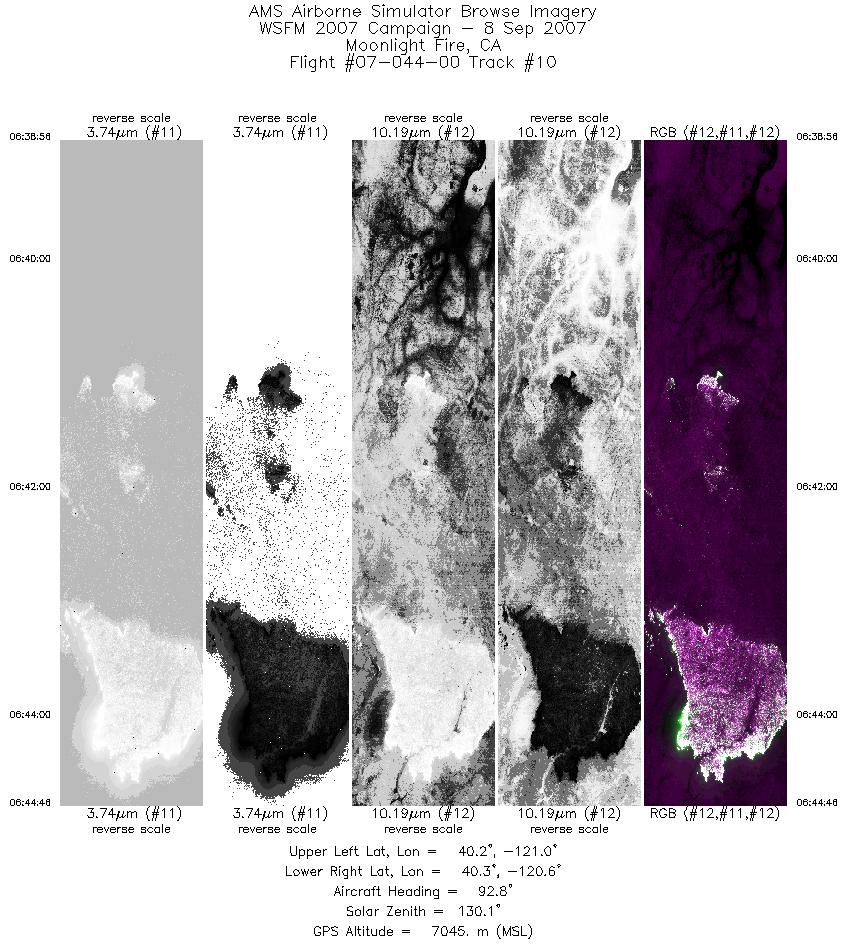
| 10 |
06:38 - 06:44 |
92.8 |
40.222 - 40.213 |
120.967 - 120.649 |
3332 |
7042 |
| 11 |
06:47 - 06:54 |
264.8 |
40.287 - 40.291 |
120.599 - 120.929 |
3757 |
7049 |
| 12 |
08:23 - 08:28 |
80.4 |
44.341 - 44.344 |
121.900 - 121.606 |
2460 |
6989 |
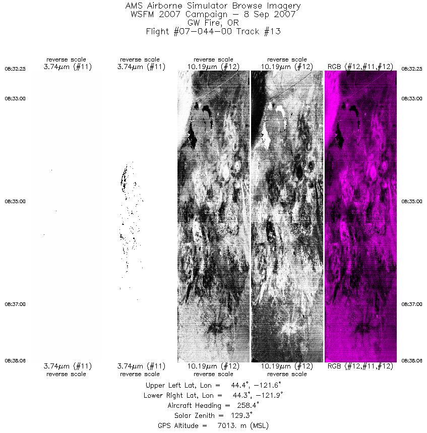
| 13 |
08:32 - 08:38 |
264.3 |
44.354 - 44.334 |
121.585 - 121.867 |
2897 |
7014 |
| 14 |
09:10 - 09:16 |
79.6 |
44.596 - 44.610 |
119.861 - 119.521 |
2854 |
6986 |
| 15 |
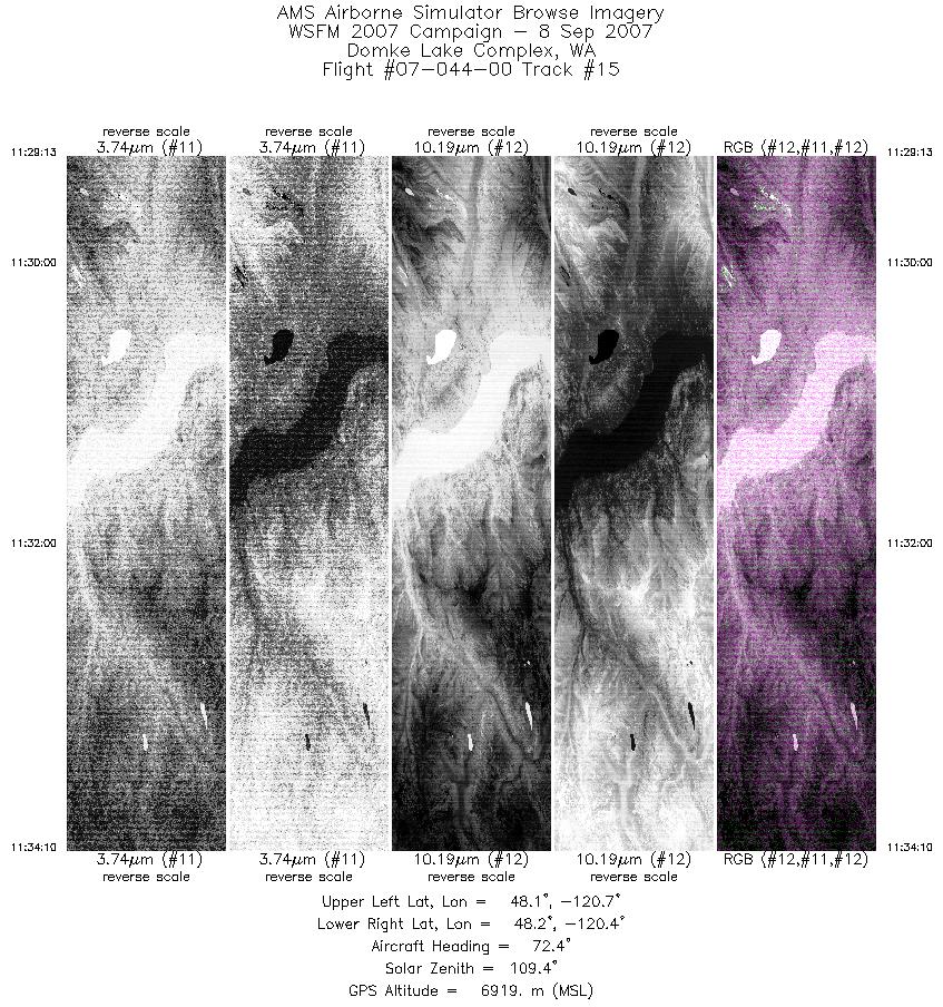
11:29 - 11:34 |
70.7 |
48.184 - 48.199 |
120.692 - 120.367 |
3123 |
6917 |
| 16 |
11:37 - 11:46 |
285.7 |
48.127 - 48.140 |
120.377 - 120.787 |
4398 |
6924 |
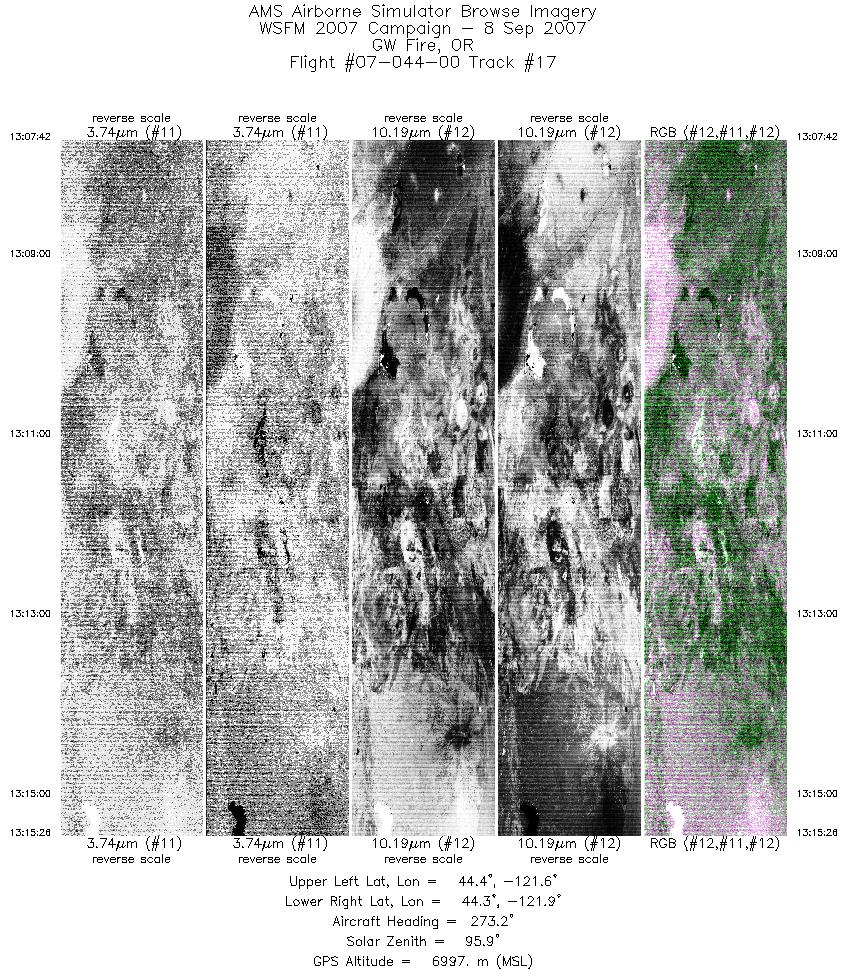
| 17 |
13:07 - 13:15 |
273.1 |
44.348 - 44.351 |
121.550 - 121.879 |
3482 |
6995 |
| 18 |
14:43 - 14:49 |
87.3 |
40.287 - 40.290 |
120.947 - 120.641 |
2763 |
7027 |
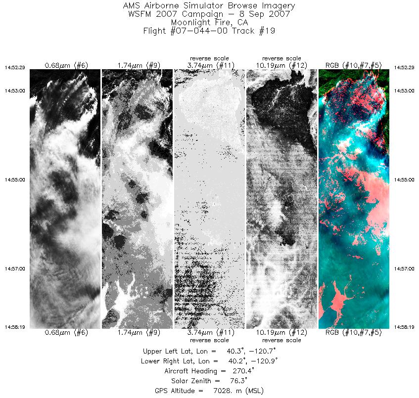
| 19 |
14:52 - 14:58 |
266.9 |
40.226 - 40.223 |
120.651 - 120.940 |
2627 |
7027 |
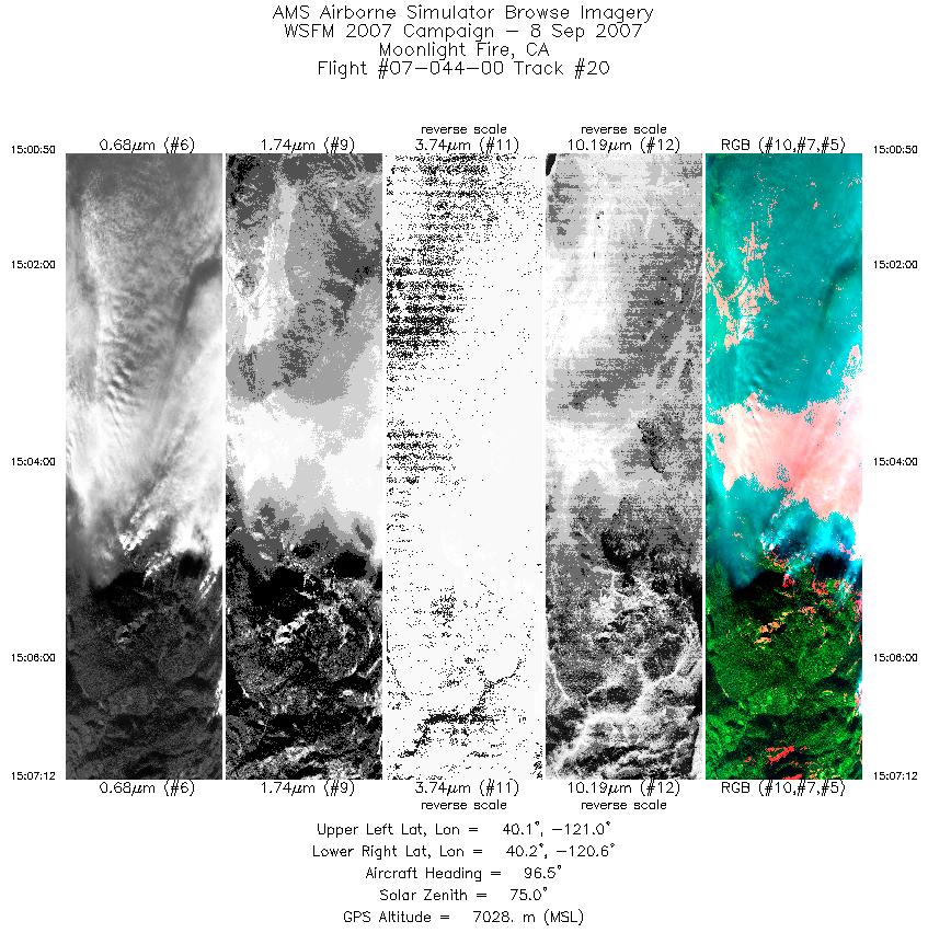
| 20 |
15:00 - 15:07 |
93.5 |
40.154 - 40.156 |
120.963 - 120.646 |
2863 |
7029 |
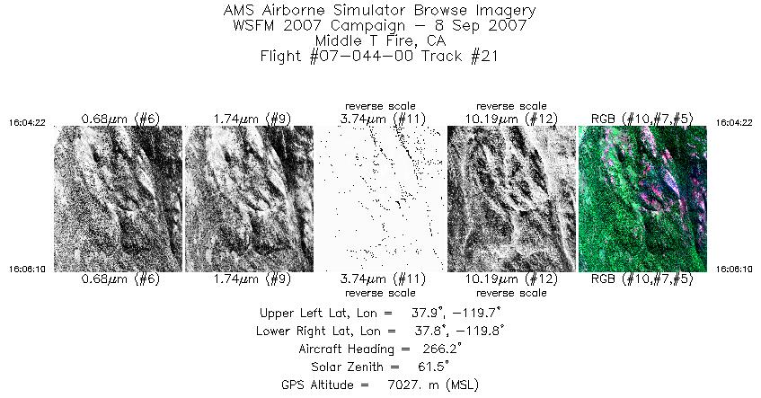
| 21 |
16:04 - 16:06 |
262.7 |
37.881 - 37.876 |
119.688 - 119.774 |
815 |
7027 |
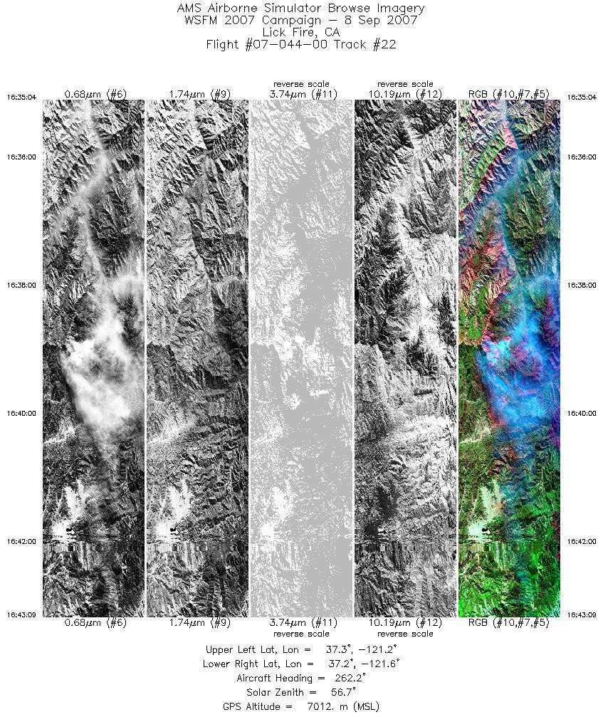
| 22 |
16:35 - 16:43 |
264.8 |
37.285 - 37.297 |
121.213 - 121.600 |
3636 |
7010 |
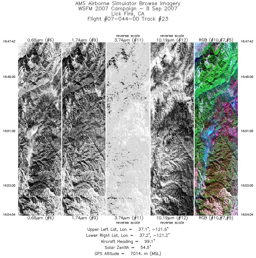
| 23 |
16:47 - 16:54 |
94.6 |
37.152 - 37.148 |
121.575 - 121.256 |
2863 |
7012 |
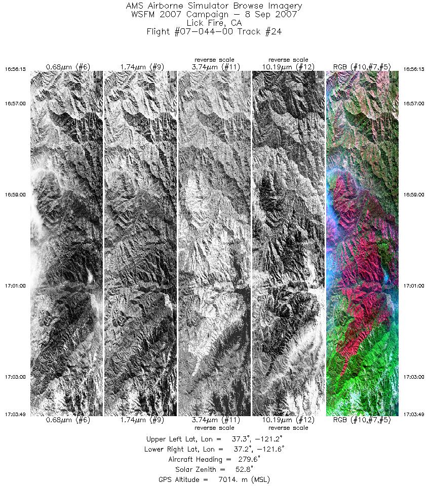
| 24 |
16:56 - 17:03 |
271.0 |
37.216 - 37.219 |
121.237 - 121.594 |
3411 |
7012 |
| 25 |
17:10 - 17:13 |
89.0 |
37.091 - 37.091 |
121.422 - 121.257 |
1479 |
7015 |
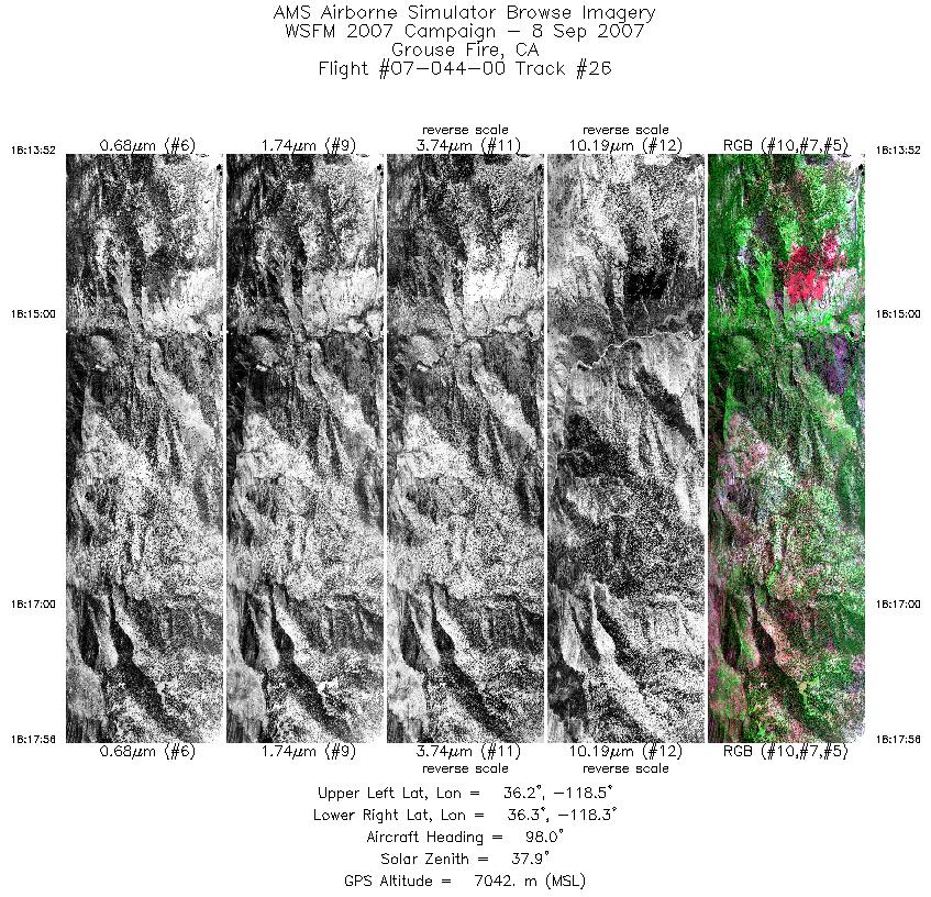
| 26 |
18:13 - 18:17 |
96.6 |
36.277 - 36.277 |
118.466 - 118.289 |
2684 |
7039 |
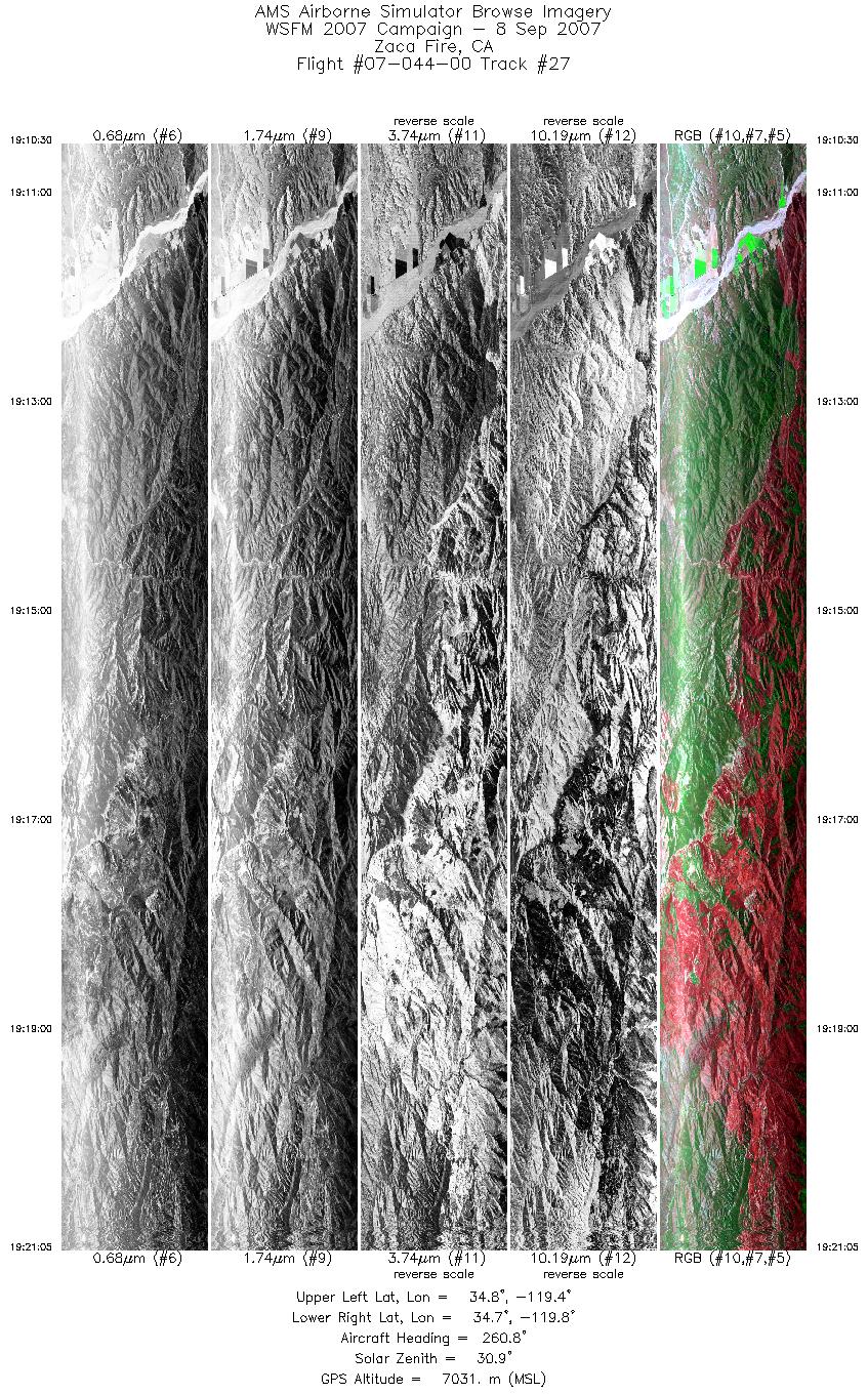
| 27 |
19:10 - 19:21 |
260.6 |
34.778 - 34.775 |
119.386 - 119.854 |
5400 |
7023 |
| 28 |
19:34 - 19:45 |
261.7 |
34.708 - 34.714 |
119.359 - 119.868 |
5808 |
7038 |
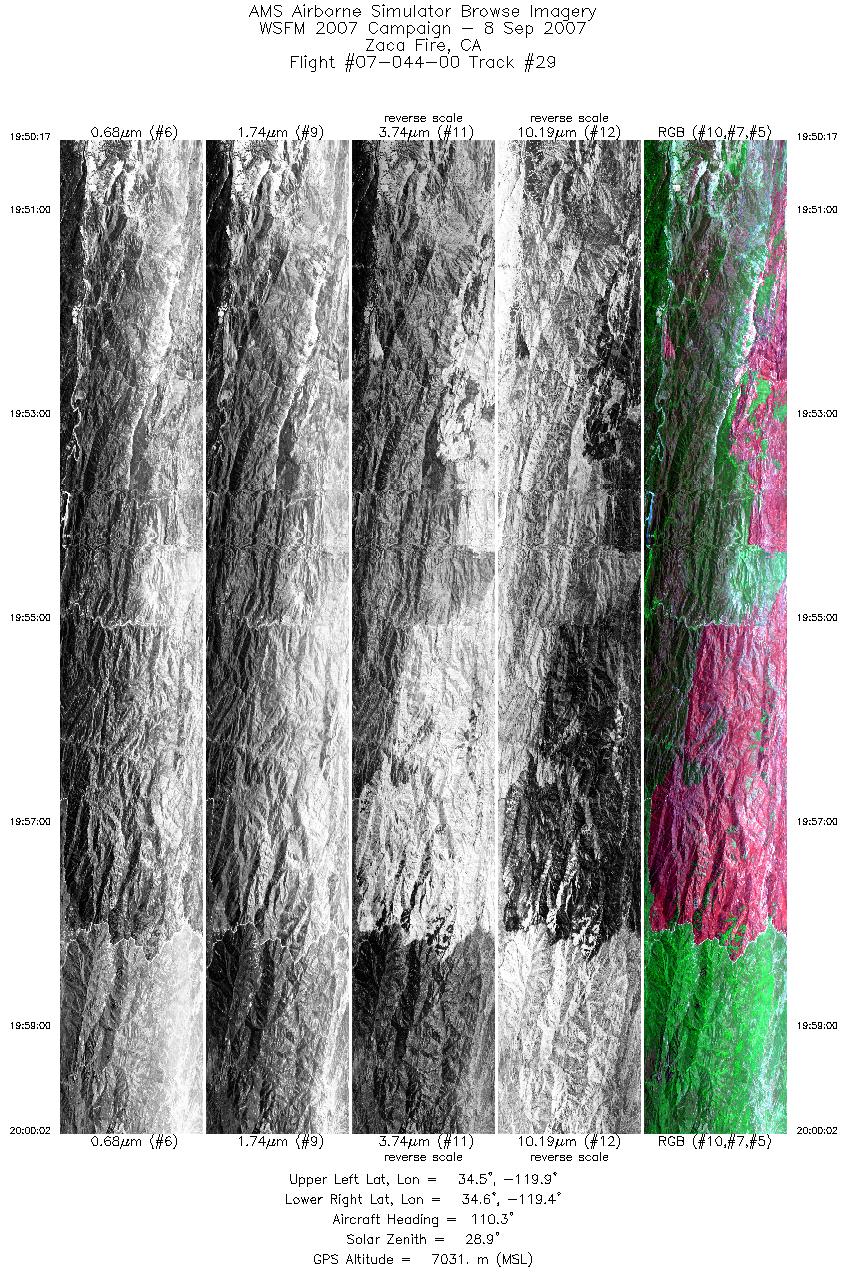
| 29 |
19:50 - 20:00 |
104.4 |
34.578 - 34.578 |
119.848 - 119.373 |
4974 |
7030 |
| 30 |
20:02 - 20:11 |
257.7 |
34.518 - 34.514 |
119.400 - 119.821 |
4761 |
7032 |
| 31 |
20:17 - 20:28 |
93.9 |
34.647 - 34.653 |
119.810 - 119.263 |
5681 |
7031 |
|


