Flight: 07-001-02
Date: 25 Oct 2006
Location: Yosemite N.P. / Southern California (day / night)
Deployment: WSFM 2006
Configuration: Land 2.5 (12-Channel)
Principal Investigators: Ambrosia (CSUMB)
Additional Sensors: ARGUS / UCATS
|
Data Evaluation
Overall quality is good
|
Processing Information
Level-1B Data in HDF format is available
Flight Line Summary
Spectral Band Configuration
Spectral Response Function Table
Spectral Response Function (text)
|
Browse Imagery
Flight Tracks: 35
Scanlines: 265820
|
Browse Imagery Table
|
Click a Flight Track number to view a quicklook image
Lat/Lon ranges are for the BEG-END scanline nadir pixels
|
Flight
Track |
Time Span
(GMT) |
Heading
(Deg) |
Lat Range
(Deg N) |
Lon Range
(Deg W) |
Length
(Scanlines) |
Altitude
(Meters) |
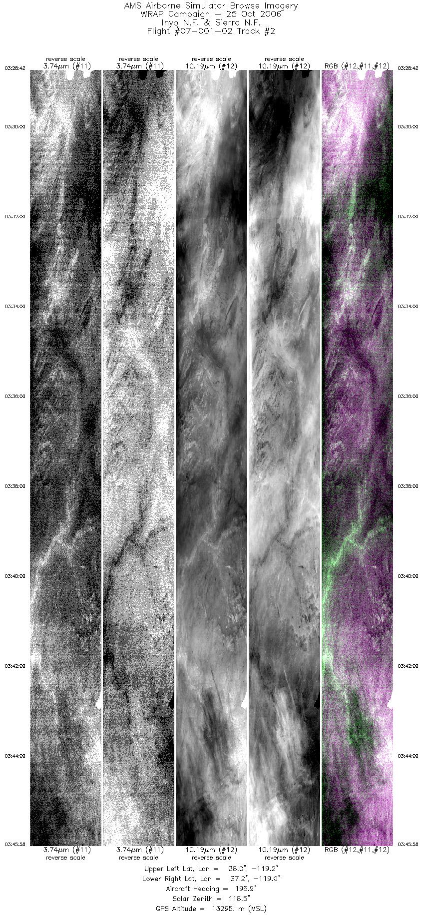
| 1 |
03:11 - 03:23 |
343.6 |
37.336 - 37.963 |
118.924 - 118.949 |
5703 |
13307 |
| 2 |
03:28 - 03:45 |
195.6 |
37.961 - 37.270 |
119.088 - 119.094 |
7773 |
13299 |
| 3 |
03:50 - 04:04 |
342.2 |
37.291 - 37.991 |
119.260 - 119.223 |
6312 |
13306 |
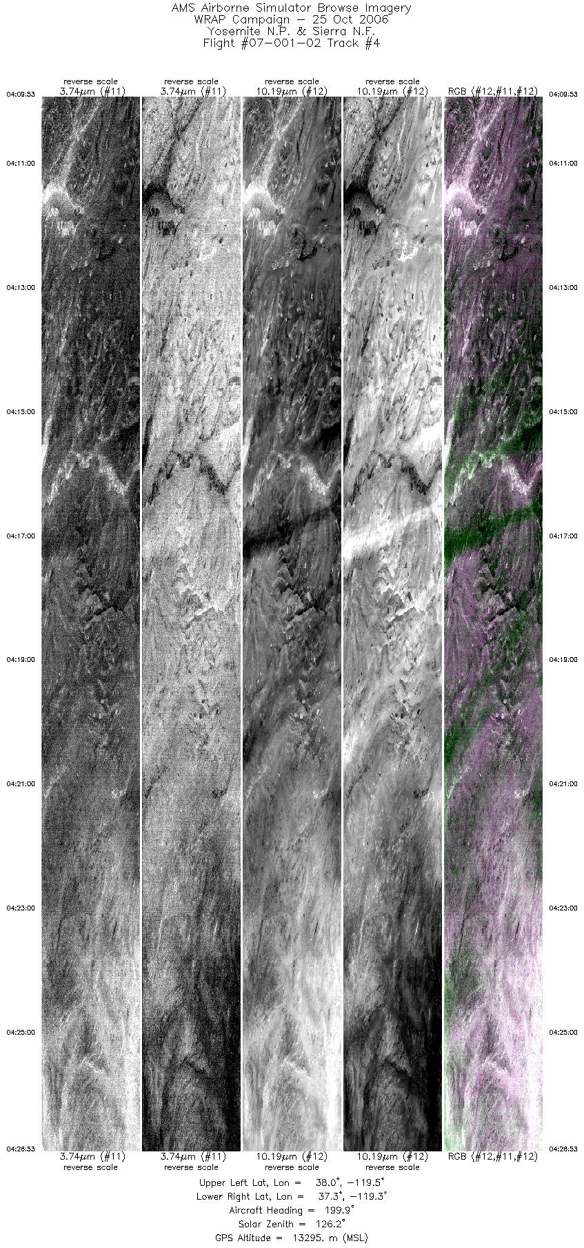
| 4 |
04:09 - 04:26 |
198.2 |
37.993 - 37.283 |
119.419 - 119.422 |
7644 |
13288 |
| 5 |
04:32 - 04:45 |
350.1 |
37.372 - 37.995 |
119.577 - 119.586 |
5725 |
13287 |
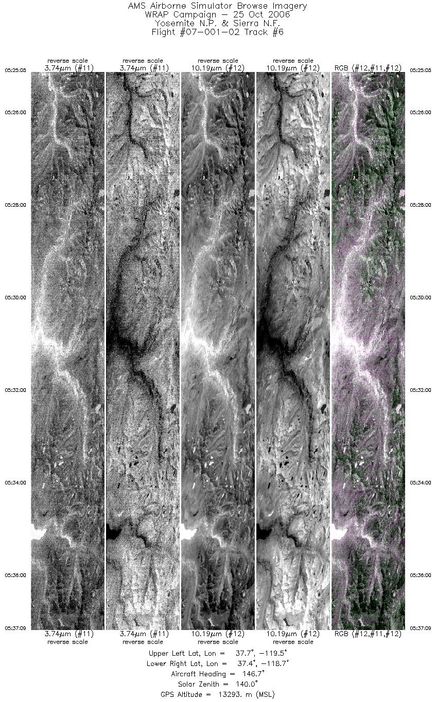
| 6 |
05:25 - 05:37 |
146.8 |
37.773 - 37.360 |
119.393 - 118.784 |
5428 |
13301 |
| 7 |
05:42 - 05:53 |
347.3 |
37.344 - 37.971 |
118.466 - 118.450 |
5210 |
13290 |
| 8 |
06:21 - 06:36 |
339.6 |
37.287 - 37.992 |
118.776 - 118.794 |
6483 |
13284 |
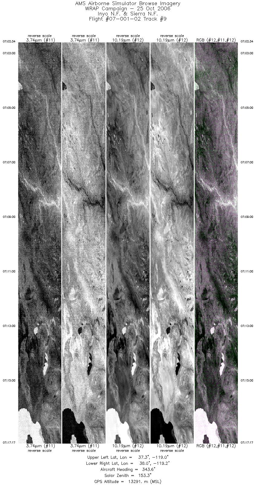
| 9 |
07:02 - 07:17 |
343.0 |
37.277 - 37.984 |
119.100 - 119.082 |
6620 |
13293 |
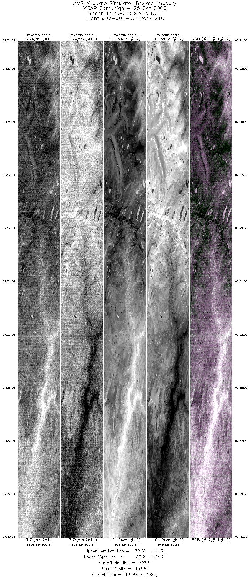
| 10 |
07:21 - 07:40 |
203.1 |
37.990 - 37.280 |
119.233 - 119.266 |
8401 |
13280 |
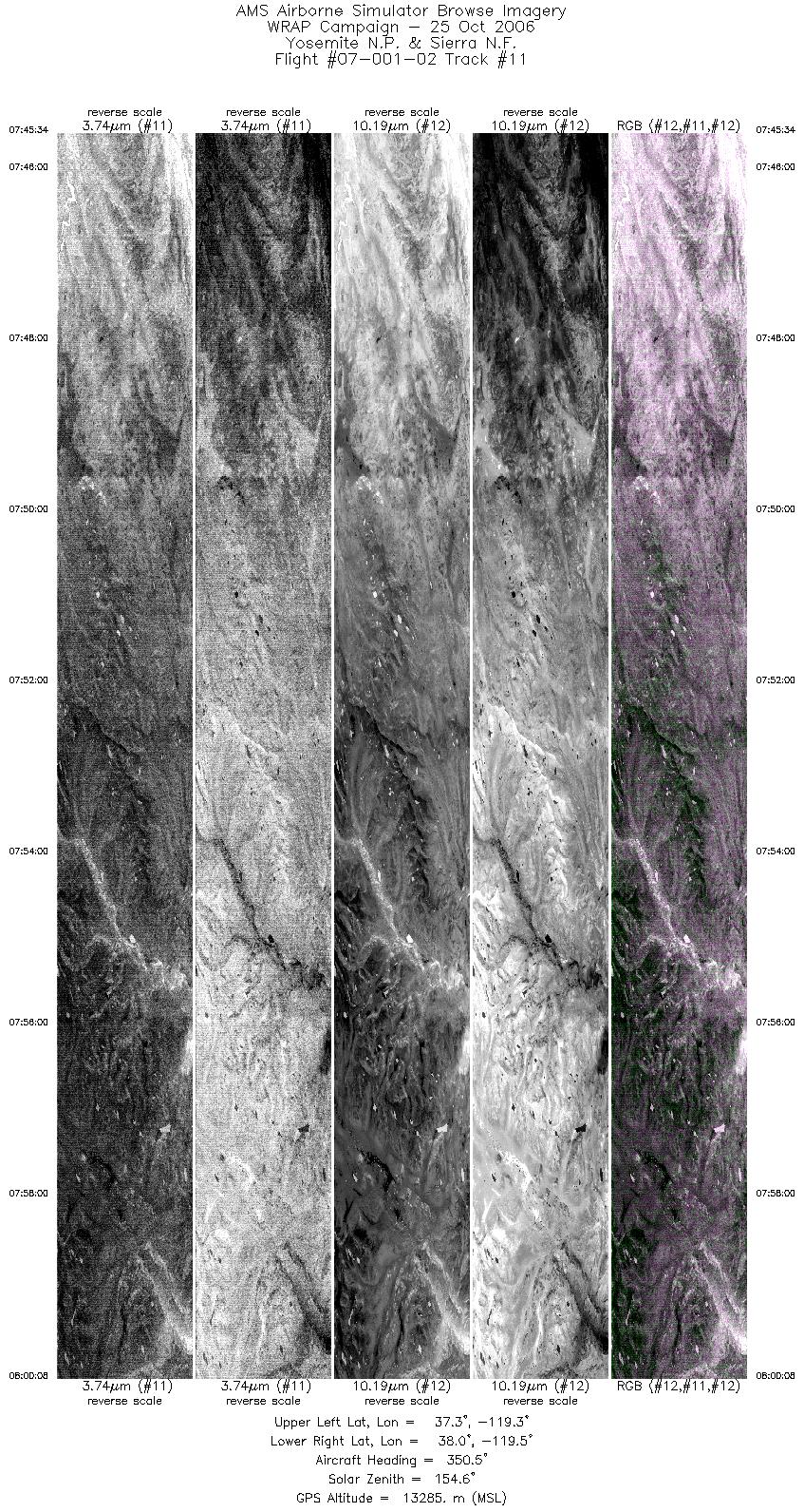
| 11 |
07:45 - 08:00 |
346.5 |
37.286 - 37.985 |
119.424 - 119.406 |
6558 |
13287 |
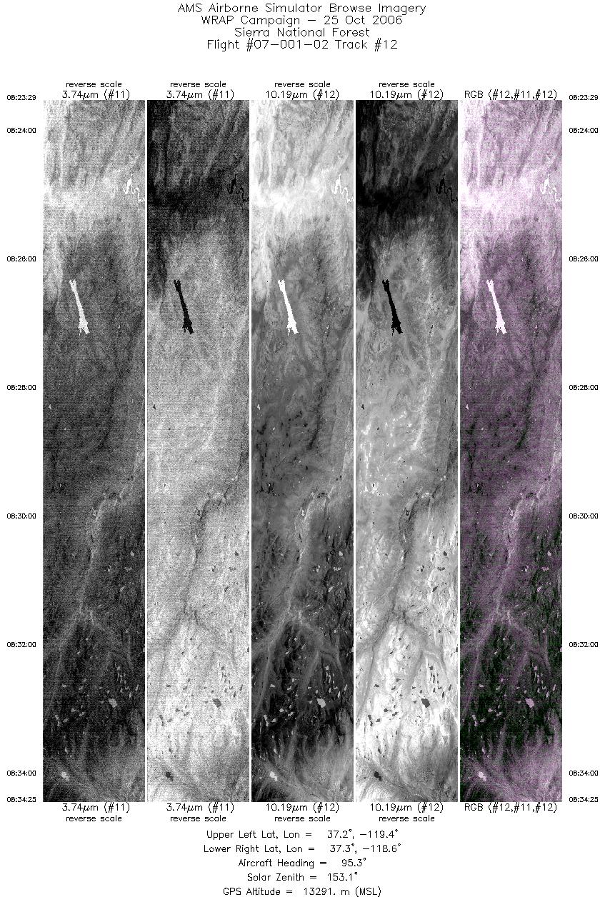
| 12 |
08:23 - 08:34 |
96.6 |
37.276 - 37.250 |
119.441 - 118.576 |
4919 |
13299 |
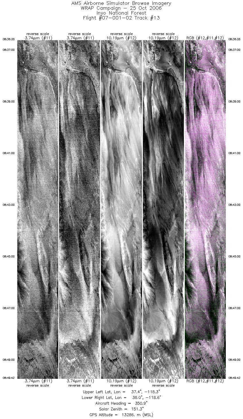
| 13 |
08:36 - 08:49 |
345.3 |
37.343 - 37.983 |
118.471 - 118.464 |
5902 |
13316 |
| 14 |
09:20 - 09:32 |
198.0 |
37.762 - 37.313 |
118.955 - 118.940 |
5473 |
13281 |
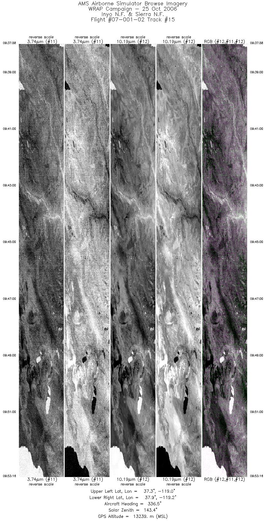
| 15 |
09:37 - 09:53 |
337.3 |
37.276 - 37.960 |
119.083 - 119.079 |
6890 |
13225 |
| 16 |
10:23 - 10:37 |
339.6 |
37.338 - 37.971 |
119.409 - 119.381 |
6322 |
13274 |
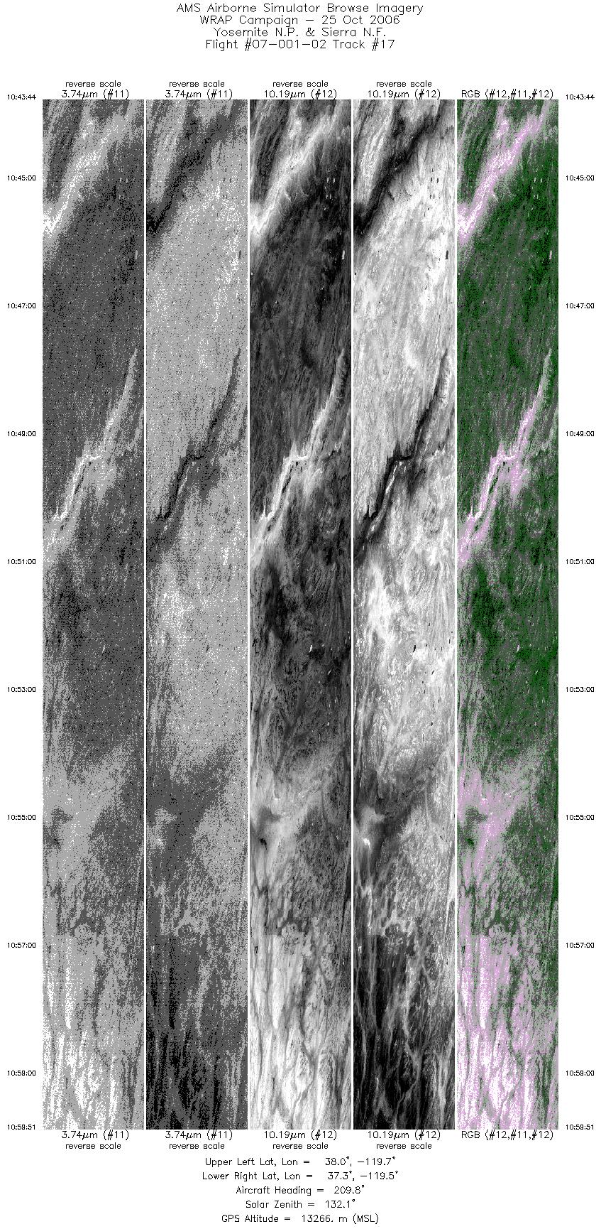
| 17 |
10:43 - 10:59 |
205.8 |
37.970 - 37.337 |
119.568 - 119.567 |
7252 |
13269 |
| 18 |
11:13 - 11:23 |
342.1 |
37.537 - 37.967 |
119.725 - 119.725 |
4489 |
13273 |
| 19 |
11:31 - 11:40 |
95.2 |
37.811 - 37.812 |
119.468 - 118.757 |
4165 |
13260 |
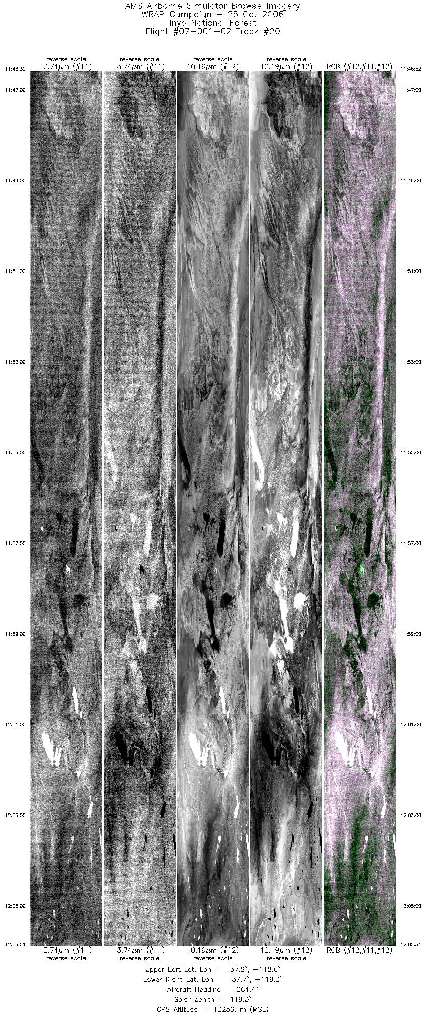
| 20 |
11:46 - 12:05 |
269.6 |
37.811 - 37.810 |
118.597 - 119.255 |
8695 |
13260 |
| 21 |
12:08 - 12:13 |
92.4 |
37.733 - 37.743 |
119.200 - 118.800 |
2330 |
13266 |
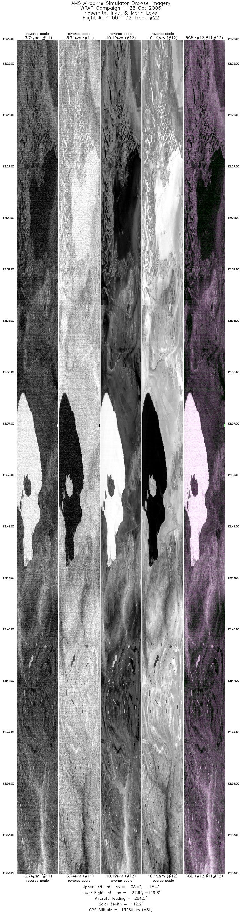
| 22 |
12:22 - 12:54 |
270.6 |
37.957 - 37.961 |
118.430 - 119.583 |
14597 |
13253 |
| 23 |
13:00 - 13:13 |
88.0 |
37.798 - 37.802 |
119.556 - 118.578 |
5906 |
13262 |
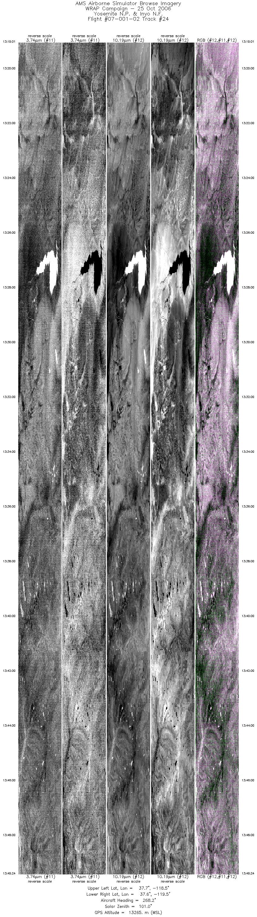
| 24 |
13:19 - 13:49 |
270.5 |
37.650 - 37.654 |
118.469 - 119.528 |
13674 |
13270 |
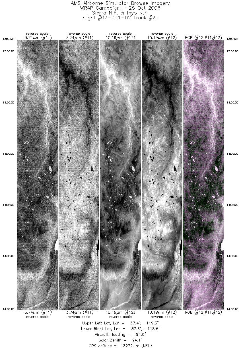
| 25 |
13:57 - 14:08 |
90.5 |
37.504 - 37.508 |
119.330 - 118.552 |
4756 |
13274 |
| 26 |
14:15 - 14:43 |
272.0 |
37.801 - 37.803 |
118.521 - 119.526 |
12416 |
13275 |
| 27 |
14:56 - 15:09 |
94.3 |
37.343 - 37.344 |
119.527 - 118.578 |
5878 |
13274 |
| 28 |
15:16 - 15:47 |
263.4 |
37.503 - 37.503 |
118.500 - 119.543 |
13973 |
13265 |
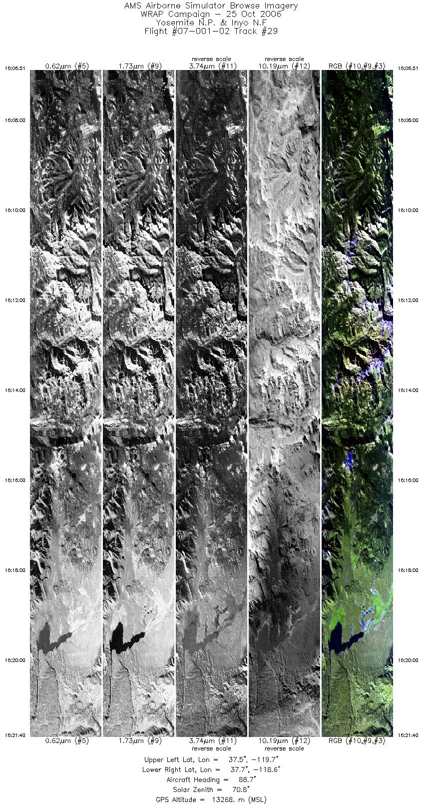
| 29 |
16:06 - 16:21 |
92.0 |
37.649 - 37.652 |
119.665 - 118.579 |
6672 |
13264 |
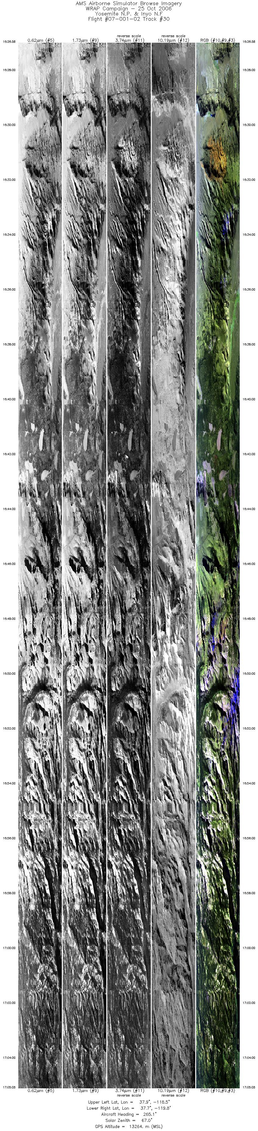
| 30 |
16:26 - 17:05 |
266.3 |
37.803 - 37.803 |
118.487 - 119.772 |
17153 |
13255 |
| 31 |
17:13 - 17:31 |
94.5 |
37.955 - 37.954 |
119.792 - 118.564 |
7720 |
13291 |
| 32 |
17:50 - 18:13 |
266.8 |
37.348 - 37.345 |
118.622 - 119.390 |
10326 |
13290 |
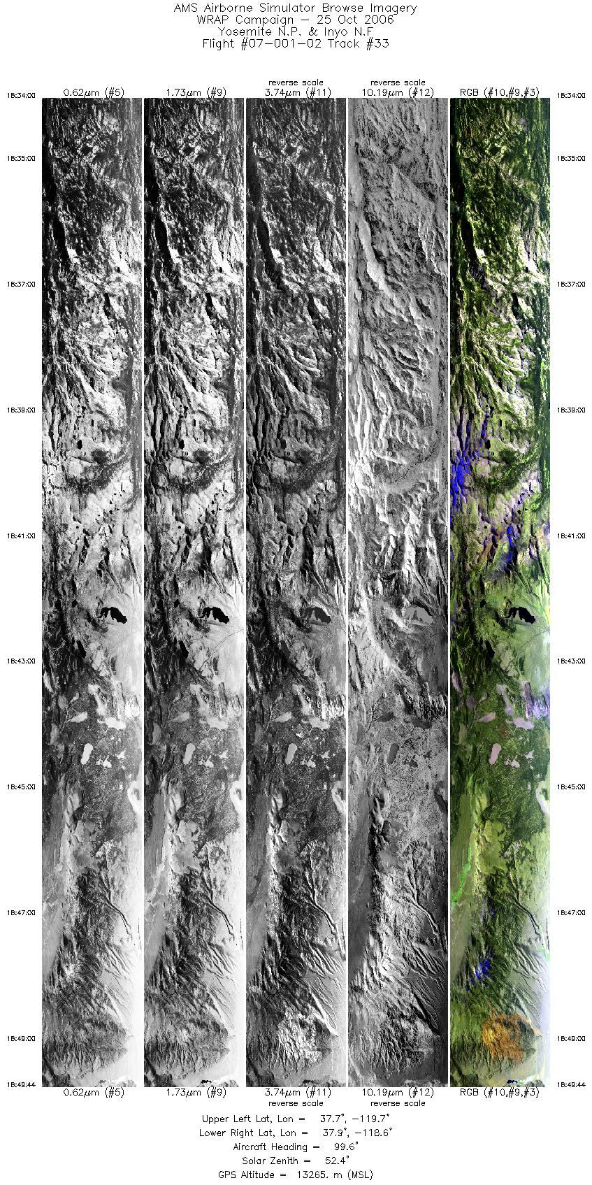
| 33 |
18:34 - 18:49 |
95.2 |
37.809 - 37.801 |
119.684 - 118.571 |
7078 |
13281 |
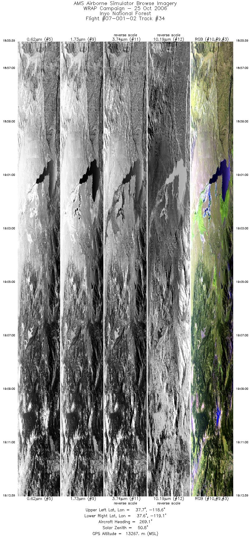
| 34 |
18:55 - 19:12 |
270.1 |
37.654 - 37.655 |
118.573 - 119.133 |
7657 |
13272 |
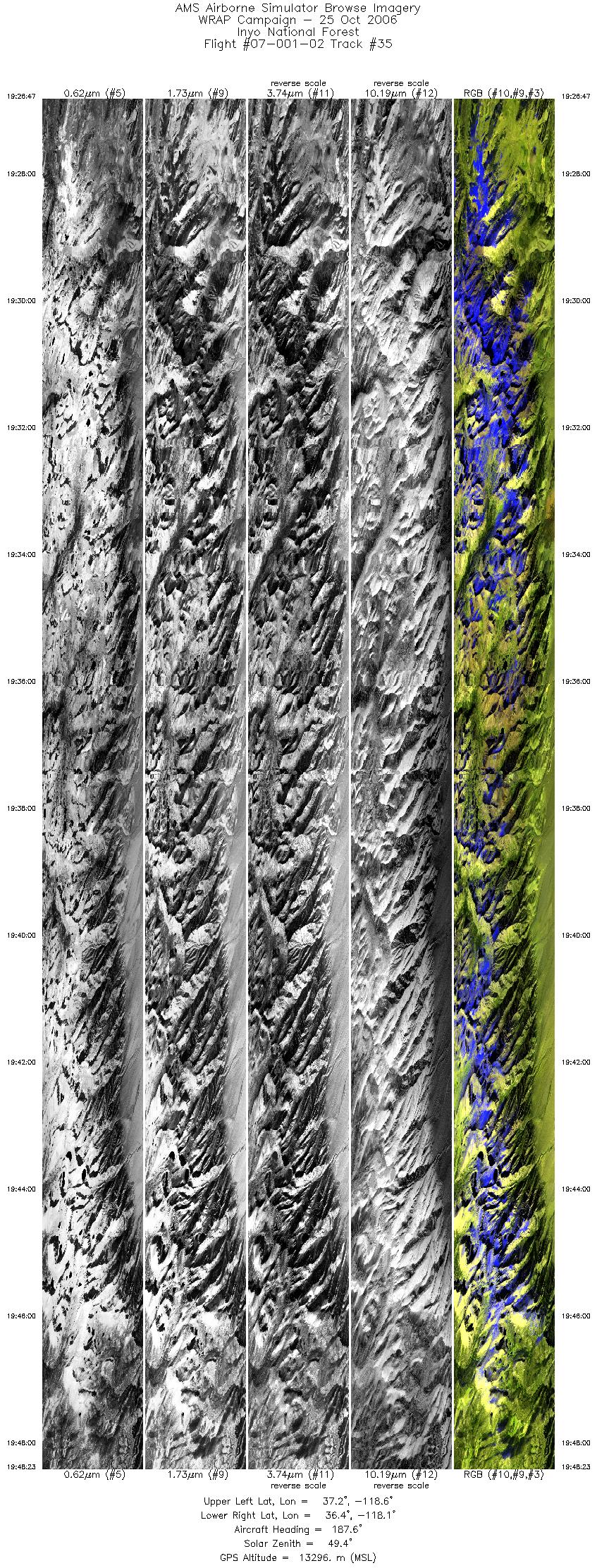
| 35 |
19:26 - 19:48 |
186.2 |
37.230 - 36.424 |
118.495 - 118.190 |
9720 |
13298 |
|


