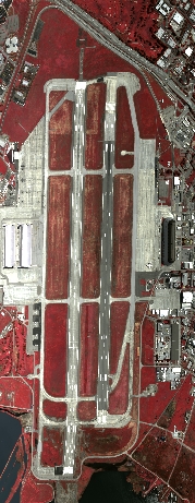
Flight: 06-004-01
Date: 18 Apr 2006
Location: Monterey Bay / San Francisco Bay, California
Deployment: ARC April 2006
Configuration: Land 2.5 (12-Channel)
Principal Investigators: Functional Check Flight
Additional Sensors: None
|
Data Evaluation
Overall quality is good
|
Processing Information
Level-1B Data in HDF format is available
Flight Line Summary
Spectral Band Configuration
Spectral Response Function Table
Spectral Response Function (text)
|
Browse Imagery
Flight Tracks: 15
Scanlines: 53685
|
Browse Imagery Table
|
Click a Flight Track number to view a quicklook image
Lat/Lon ranges are for the BEG-END scanline nadir pixels
|
Flight
Track |
Time Span
(GMT) |
Heading
(Deg) |
Lat Range
(Deg N) |
Lon Range
(Deg W) |
Length
(Scanlines) |
Altitude
(Meters) |
| 1 |
21:48 - 21:50 |
338.1 |
37.392 - 37.430 |
122.037 - 122.057 |
2344 |
772 |
| 2 |
21:52 - 21:53 |
62.1 |
37.406 - 37.417 |
122.075 - 122.040 |
1703 |
783 |
| 3 |
21:56 - 21:59 |
145.5 |
37.372 - 37.292 |
122.054 - 121.983 |
4145 |
1147 |
| 4 |
22:15 - 22:23 |
92.9 |
37.084 - 37.062 |
121.407 - 120.997 |
5184 |
3295 |
| 5 |
22:27 - 22:30 |
286.9 |
37.043 - 37.060 |
120.901 - 121.029 |
5292 |
1289 |
| 6 |
22:30 - 22:36 |
263.8 |
37.060 - 37.053 |
121.032 - 121.228 |
8331 |
1063 |
| 7 |
22:38 - 22:48 |
233.2 |
36.999 - 36.790 |
121.314 - 121.606 |
6236 |
2429 |
| 8 |
22:48 - 22:50 |
227.4 |
36.790 - 36.716 |
121.607 - 121.697 |
1521 |
3184 |
| 9 |
22:50 - 22:54 |
235.8 |
36.712 - 36.638 |
121.702 - 121.874 |
2295 |
3178 |
| 10 |
22:56 - 23:01 |
14.3 |
36.606 - 36.811 |
121.825 - 121.764 |
3377 |
3205 |
| 11 |
23:06 - 23:08 |
119.1 |
36.842 - 36.795 |
121.807 - 121.715 |
1382 |
3196 |
| 12 |
23:13 - 23:16 |
48.3 |
36.788 - 36.884 |
121.807 - 121.712 |
2025 |
3179 |
| 13 |
23:19 - 23:26 |
322.2 |
36.998 - 37.190 |
121.663 - 121.904 |
4308 |
3190 |
| 14 |
23:26 - 23:33 |
332.5 |
37.194 - 37.470 |
121.906 - 122.083 |
4696 |
3188 |
| 15 |
23:37 - 23:38 |
61.9 |
37.397 - 37.423 |
122.088 - 122.030 |
846 |
3185 |
|


